Eastern Crete has dozens of enchanting and unknown destinations that "capture" every visitor, making him…
Ha Gorge
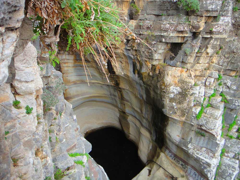
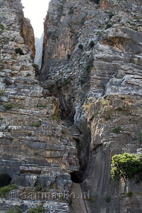
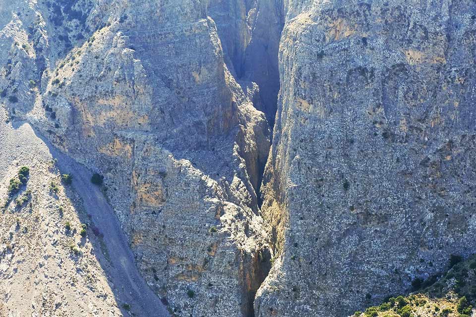
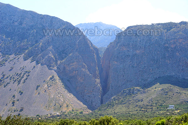
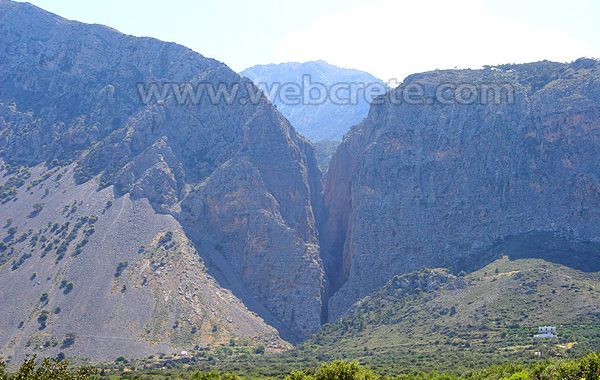
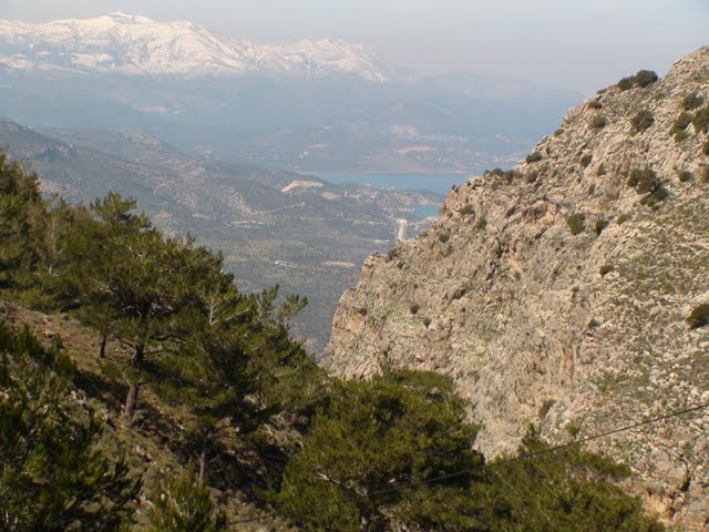
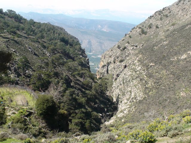
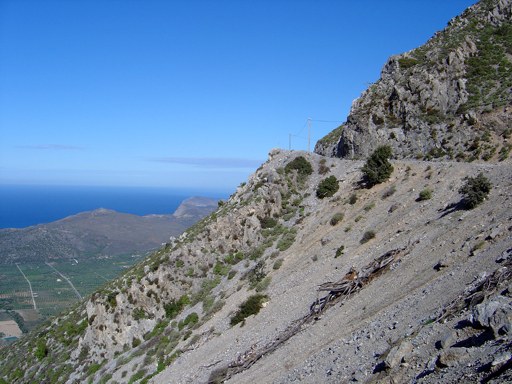
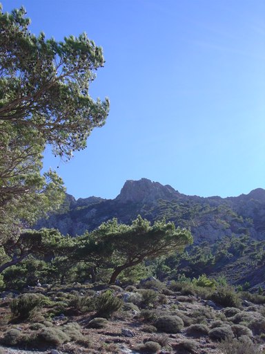
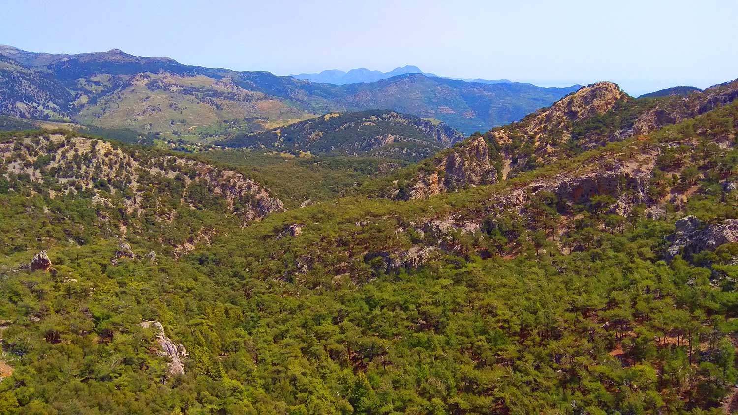
Ha Gorge is a canyon on the eastern part of the island of Crete in Greece. It is located in the west slope of Thrypti mountain and near of Monastiraki village in the plain of Ierapetra. The gorge is about 1.5km long, particularly narrow at several points and has walls rising up to 300m. Although there are many different versions about the origin of its name, the one that prevails is etymologically derived from the verb hasko (Greek: χάσκω) meaning to open or part widely, to gape. Ha is considered to be one of the wildest gorges in Crete and one of the most difficult to cross.
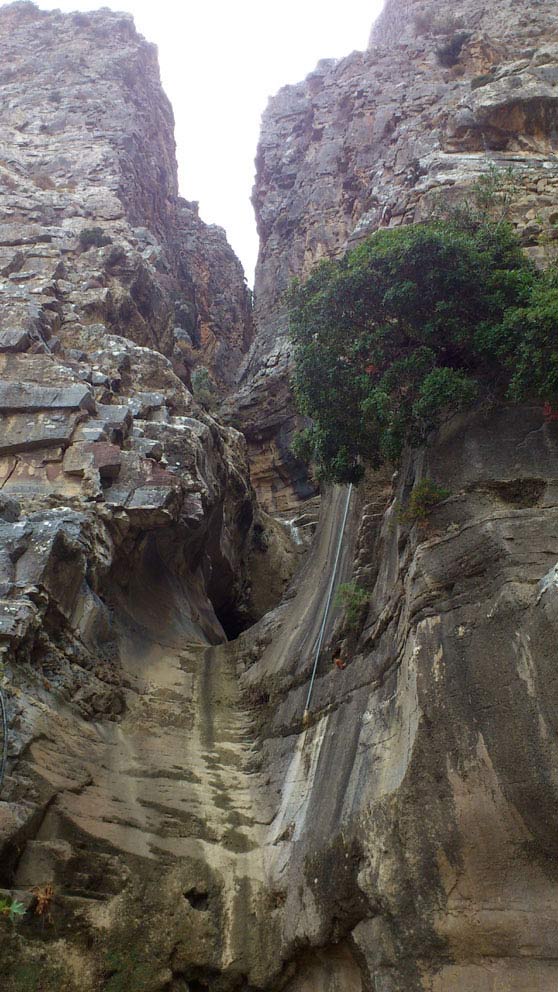
Ha Canyon located in Lassithi. The entrance is just three meters, is located at an altitude of 370m. and the output goes downhill and ends at a
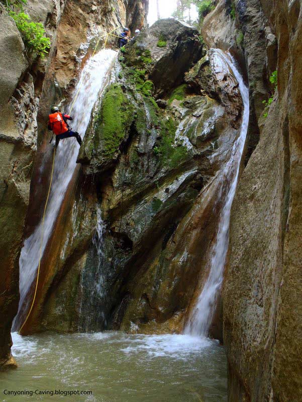
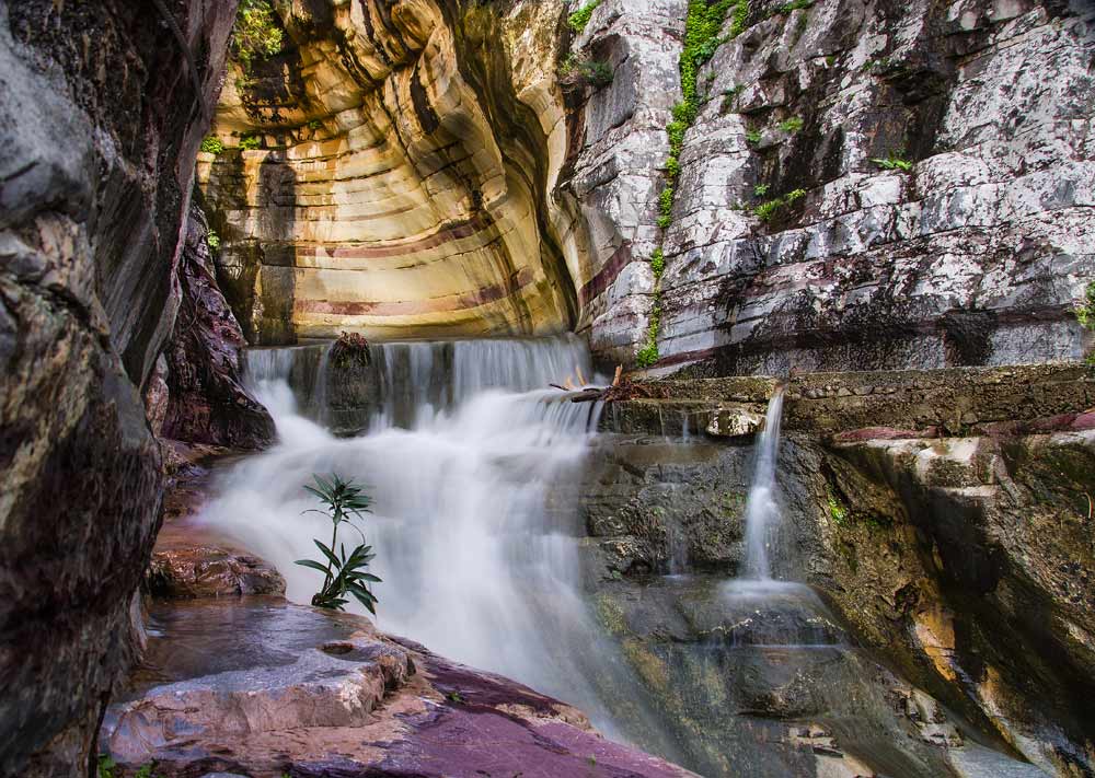
n elevation of 140m. It has about 33 rappels the largest of which reaches a height of 35m. Generally have very narrow walls, with only a few centimeters wide. Towards the end of the gorge waterfall poured a large amount of 215 meters.
The gorge of Ha has 26 technical descents, the largest of which is 30 meters. and almost no walking. That is why the visitors that enter inside are mainly experienced climbers, as it is quite dangerous. Considered one of the wildest gorges of Greece and one of the most difficult to traverse, but one of the 10 most beautiful in Europe.
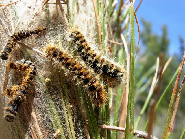
The canyon has a rich flora and fauna. The ponds are important wetlands for many migratory birds, but also permanently birds and mammals. Since mammalian species is dominated by the Cretan hare, and found and the Cretan weasel (kalogynaikari) and the Cretan badger (Arkalon). She also observed the spiny mouse, a rodent that does not exist elsewhere in Europe and the african wildlife. The canyon will encounter the pine trees and many other species of trees and shrubs, herbs and flowers. Many rare and endangered plant species have found refuge in the great ravine.
You could say that the canyon is a virgin habitat untouched by humans since the configuration prohibits anyone to know well, to traverse or exploit. The first who crossed in 1987 are three Thessalonians climbers, experienced and adventurous and time it took seven days efforts. Today the canyon is insured and is a heavenly destination for canyoning. The gorge is about 33 rappels, the largest has a height of 35 meters. Some parts are very narrow, with a width of only a few centimeters, which makes it special.
Near Ha are old stone mills that are now deserted, monuments of a bygone era. A legend says that in the depths of chaos, in the heart of Ha is buried a golden chariot, pulled by horses gold. And is gold cords, the diamond of Ploumidi. Sparkle in the sun so that it dazzled Crete Cretan bold when someone found the golden chariot. To go to one where it is to be tied with ropes and slip into the rock.
Additional Info
Altitude: 120m (Monastiraki) to 590m (Thripti Plateau)
Starting point: Monastiraki Village
Path Type: Not passable inside the gorge. Only by the E4 trail from Monastiraki to Thripti
Difficulty: Very difficult – Only for experienced climbers
Walk distance: From Monastiraki to Thripti 9 km (E4 path)
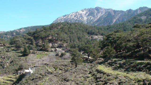
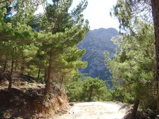
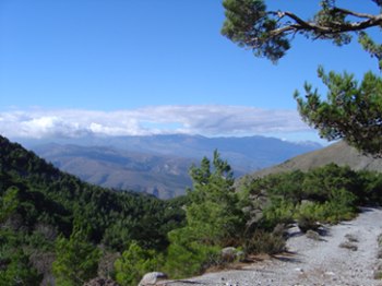
Thripti Forest and nature
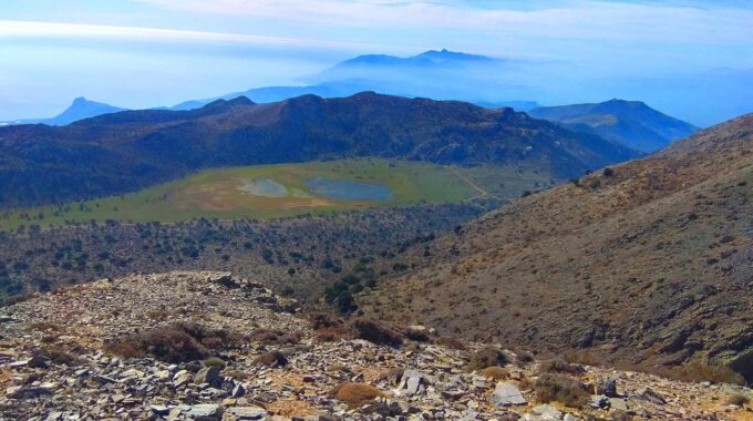
Thripti forest and Plateau are located just above the Ha Gorge area !..
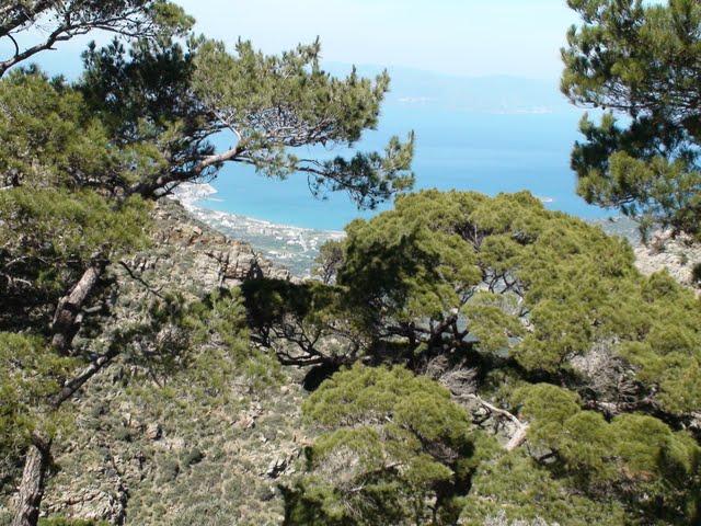
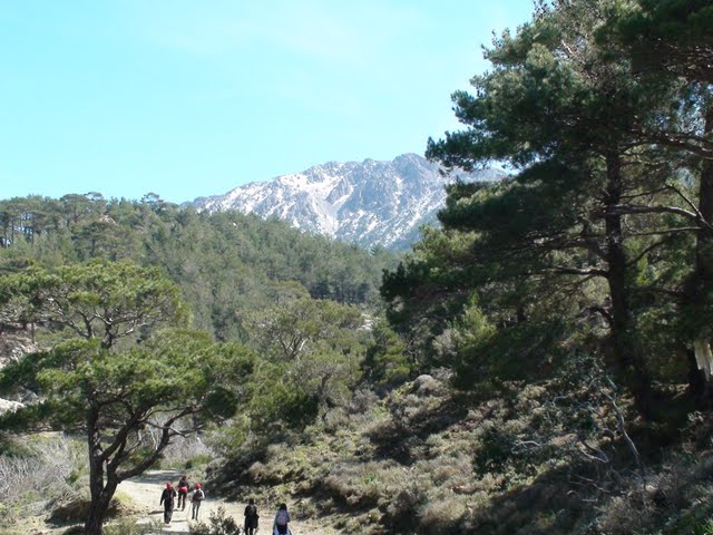
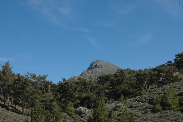
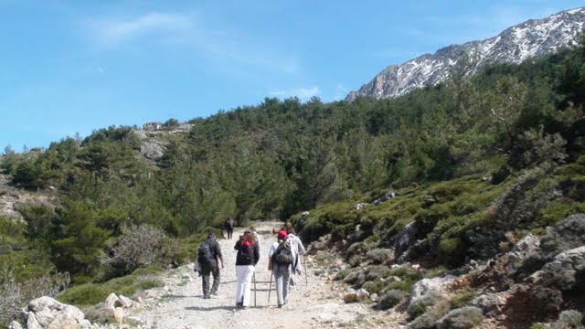
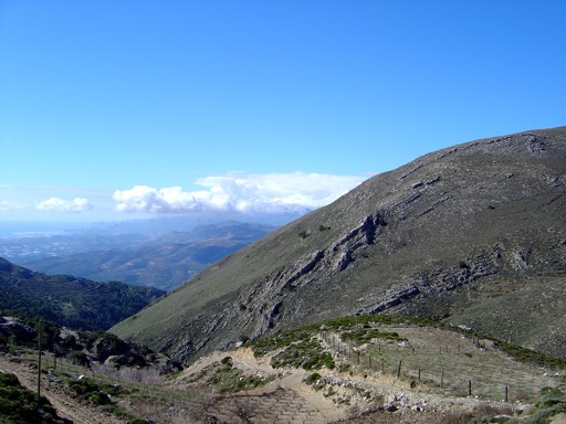
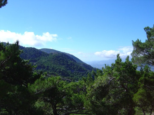
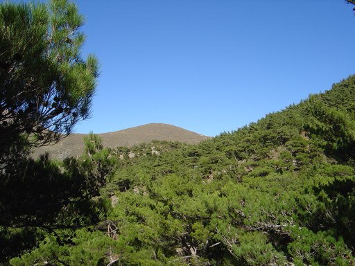
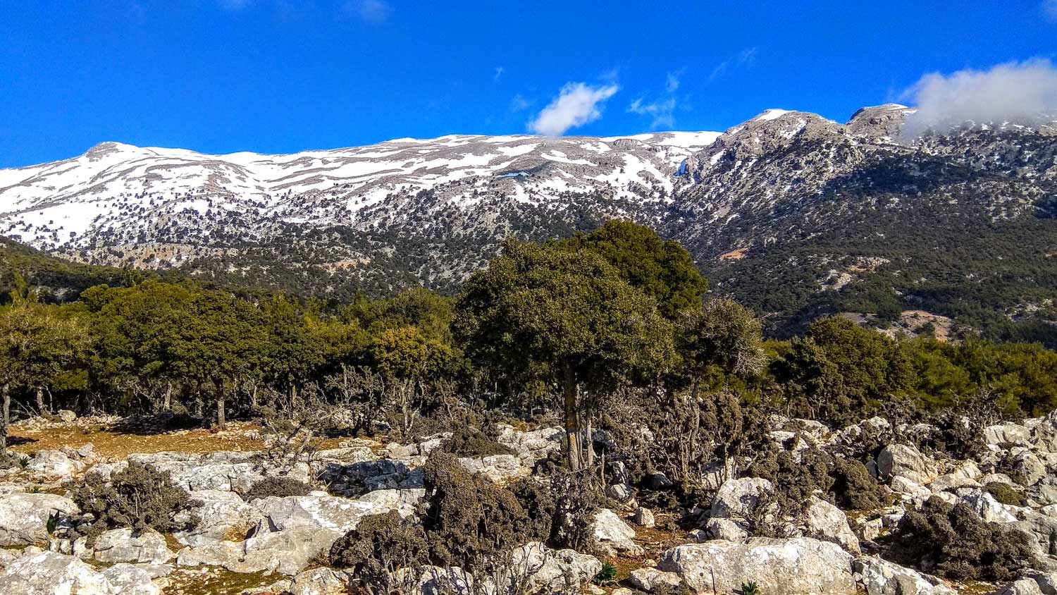
Mount Thripti is an area of extreme beauty, especially its southern slopes, which are full of Calabrian pine forest, and high biodiversity. The ridges running between the peaks of Afendis (1476m asl), Kapsa (997m), Papoura (1010m) and Koufoto (912m), the streambeds below, and the Thripti Plateau contribute to a wild landscape that is considered as one of the most important habitats in Crete, particularly for birds of prey. Thripti is also a paradise for botanists, with over 60 endemic Cretan plant species recorded, some of which are to be found only in Thripti area such as the Ierapetra bellflower (Campanula hierapetrae), an endemic helichrysum (Helichrysum doerfleri) and the endemic sandwort (Minuartia wettsteinii). The southwest part of Thripti range is of special significance for bird life.
The peaks of Koufoto and Katalimata Agiou Ioanni are major nesting sites of the lammergeier or bearded vulture (Gypaetus barbatus), griffon vulture (Gyps fulvus), golden eagle (Aquilachrysaetos), and the peregrine falcon (Falco peregrinus). There is also a significant number of marsh harriers, Eurasian sparrowhawks, short-toed eagles, Bonelli’s eagles, booted eagles, buzzards, and other raptors. At lower altitudes one can see cuckoos, chaffinches, crested larks, blackbirds, golden orioles, and other birds of brush and scrubland; alongside many farmland species.
The Village...
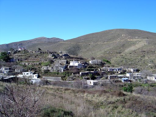
Thripti Village
More mountain climbing to go through unpaved road to an old and current mountain retreat, where excellent grape varieties produce…
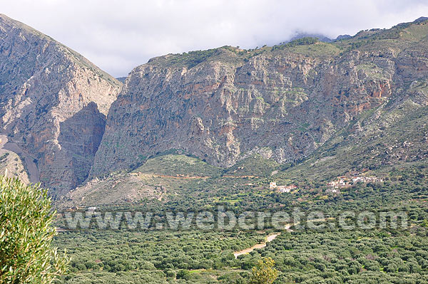
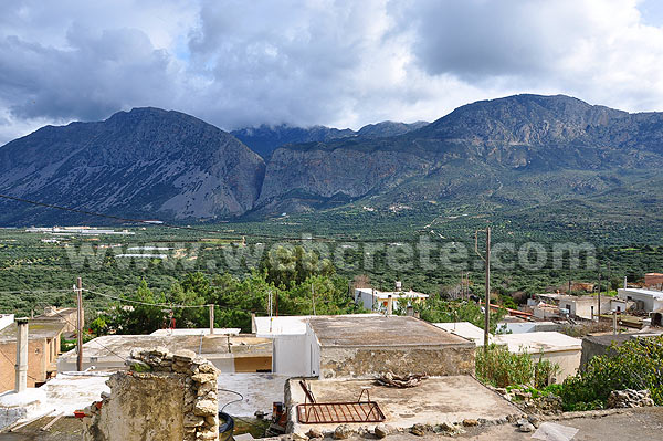
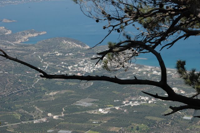
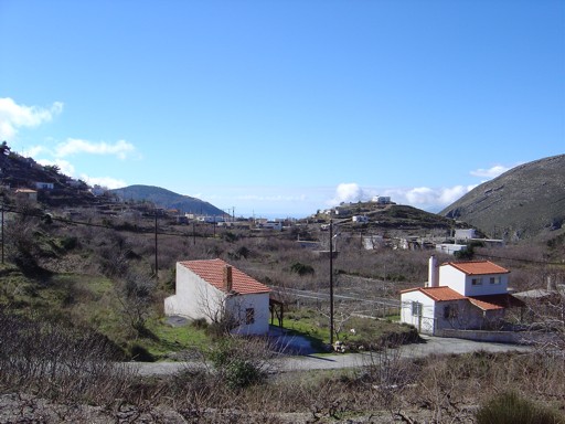
Monastiraki settlement belongs to the municipality Pachia Ammos is built at an altitude of 180 meters. It is grounded in close to the “gorge of Ha.” The Church of the Holy Spirit at the foot of hhe Ha canyon is like a magnet that attracts the eye of the visitor when the Pachia Ammos gaze across the mountain. High on top is the settlement of Thryftis, there you can reach the visitor through the Lower Village in Ierapetra and after crossing a beautiful pine forest. Monastiraki is known from about 1853 wherein said Kastrofilakas as «Monastiri» with 221 residents. It is believed that originally built in the monastery of Saints Constantine and Helena, part of the sanctuary which still survives near the church of St. Stefanos
The first houses were actually the cells of this monastery resident monks. In Egyptian census of 1834 indicated 10 families, while in the 1981 census was 18 residents. For several years there was only one resident of the village, and the last time there is a strong effort of several owners of old stone houses to renovate, and there are many who choose it as a place of residence in an attempt to escape from the hectic pace of urban life. Before about a year and completed the redevelopment project of village streets and creating a network of water supply and sewerage Public Electric hitherto rudimentary.
In the village there is the Byzantine church of St. Stephen and the church of St. George. Visitors can enjoy a coffee and try dishes from the Cretan cuisine in traditional cafe – tavern of Captain Yannis. Captain Yannis has build a fabrica just like it was old times. The room is a museum where you can go and see how the oil produced in the past. Admission for the fabrica is free, and there you can taste delicious local dishes.
From Vasiliki village (2,5 km west of Ha Gorge), we follow the asphalt road eastwards. Having passed north of the low hill with the remnants of the Early Minoan settlement, we reach the main road that connects Agios Nikolaos to Ierapetra; we cross it and get to a dirt road, at the beginning of which a shrine can be seen. We continue eastwards, rather uphill, through olive groves; we leave a double turn-off on our right side and a little further uphill another one on our left, until we come to a main unsurfaced road which we follow to the right. Having passed by an old farmhouse, we arrive at the almost abandoned settlement of Monastiraki.
We pass through the village to the top, and then climb eastwards, where we come to a dirt road which we follow in a southerly direction.
We follow this road for approximately 1.700 m andafter a characteristic right bend, we see a clear footpath on our left. This path initially runs along the western boundary of an abandoned almond grove and then ascends in a north-easterly direction, towards the top of the southern slope of the gorge of Ha.
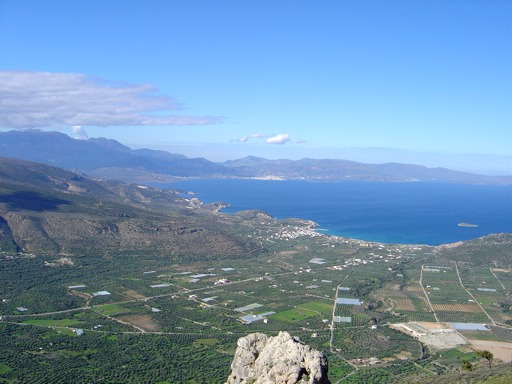
This climb is quite difficult and tiring; however it gives us the opportunity of enjoying a magnificent view of the whole bay of Mirambello, as well as of the Kavousi plain and Pachia Ammos. The Mount Dikti massif can also be seen in its entirety in the distance, to the west.
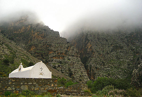
After approximately 30 minutes up the path, we reach a characteristic rock on the precipice above the gorge of Ha. Next, the path passes through a pine-clad area and then meets a dirt road to the left, which we take for approximately 1.300 m, to the picturesque chapel of Agia Anna ; there, a cool water spring is to be found under plane trees.
Down below, on the eastern bank of a stream, traces of an old charcoal makers’ settlement, to which this place owes its name (Kaminakia = small kilns) can be seen.
The stream below ends up in the gorge of Ha; this gorge is one of the most difficult in Crete to negotiate, demanding climbing skills and technical equipment.
We continue walking to the left, north of the chapel, following the main unsurfaced road and having the small ravine down below to our left. After approximately 2 km, we reach the centre of the agricultural settlement of Thripti , which is inhabited from spring to autumn.
Its houses, isolated at places or forming small clusters, are scattered on the slope, between vine terraces.
At the spot where the dirt road ends, there is a drinking fountain.
Archaeological findings at the exit of Ha Gorge and 500m far from Monastiraki Village show that there has been continuous human activity here since the Neolithic period, which increased during the turbulent times at the end of the Minoan era. Just 280m southwest of the gorge’s exit, 230m above sea level, lay the ruins of Chalasmenos, the most important and perhaps the largest ancient settlement of the 12th century BC.
The excavation of the site, undertaken by the American School of Classical Studies and the 24th Ephorate of Prehistoric and Classical Antiquities, began in 1992 and revealed large rectangular buildings, roads or cobbled streets, open spaces, a public shrine containing rare vessels, and findings dating the site back to the Late Bronze Age. A total of 27 architectural units were excavated, spread out across an area of roughly 6,5 acres on Kefala Hill. As the lead excavator Prof. Metaxia Tsipopoulou records in several publications, the settlement was built, inhabited and abandoned for unknown reasons in the 12th century BC.
The excavation findings show that there was some renewal of activity in the 8th century BC. The hill allowed the inhabitants to watch over both the Cretan and the Libyan Seas, while cultivating their crops down in the fertile valley
Walking on one of the most beautiful paths of eastern Crete, through black pine forests.…
Eastern Crete has dozens of enchanting and unknown destinations that "capture" every visitor, making him…

Lapathos Plateau is 9 kilometers far to east from Symi or Simi village in Lassithi…
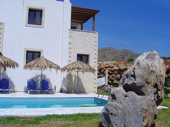
Aeolus 5 bedroom holiday rental Villa consists of 5 bedrooms each with ensuite marble bathrooms.…
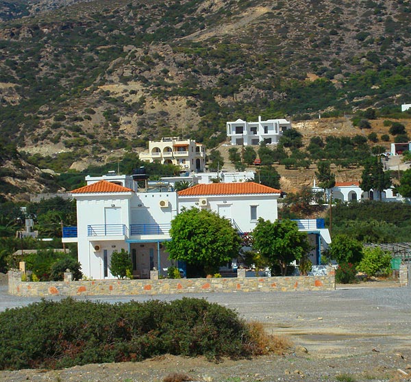
Long Beach Seaview apartments are situated next to the Long beach of Koutsounari, less than…
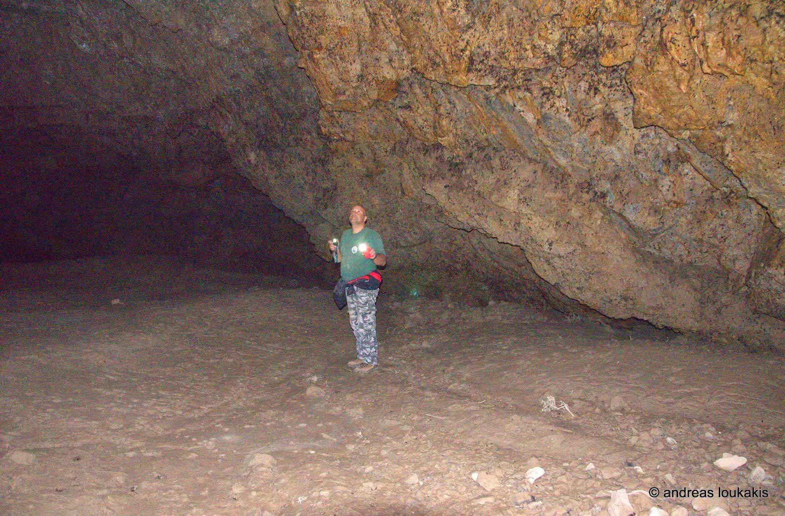
At a distance of 3.5 km southwest of the Selakano settlement and in the ravine-river…
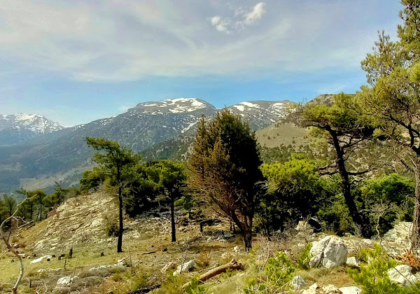
From the small settlement of Katharo located on the northern edges of the plateau and…
It is another unknown but beautiful route in the forest of Selakano. This time we…
Related Articles
This Post Has 0 Comments