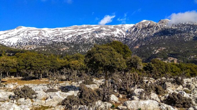
Walking on one of the most beautiful paths of eastern Crete, through black pine forests.…
Kritsa
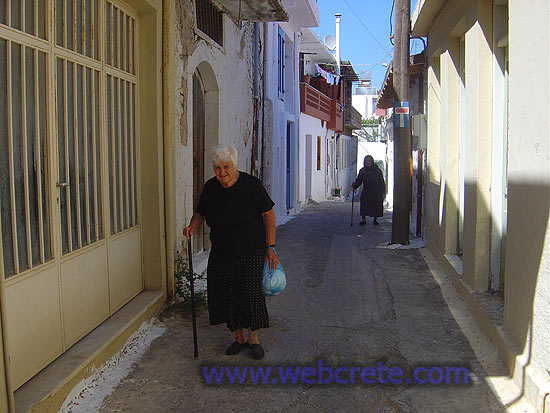
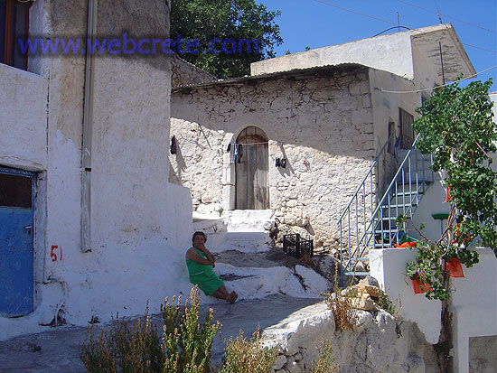
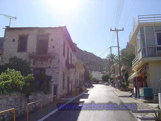
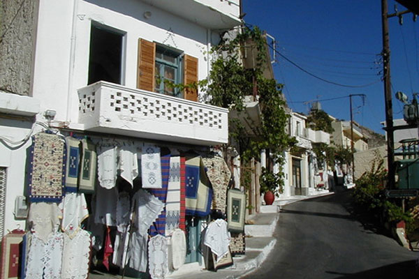
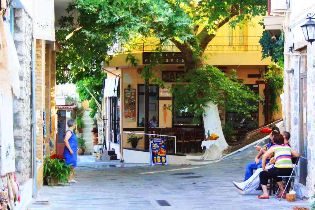
Kritsa is one of the oldest and most picturesque villages in Crete, Greece, built amphitheatrically on a rock hill, named Kastellos, surrounded by olive groves, at an altitude of 375 m. It is part of the municipality of Agios Nikolaos. During the Middle Ages, it was thought to be the largest village in Crete. Kritsa has been destroyed many times during the last centuries because it participated in all of Crete’s revolutions. It is located 10 km from Agios Nikolaos and has about 2200 inhabitants who live in different neighborhoods named Palemilos, Koukistres, Christos and Pergiolikia.
History
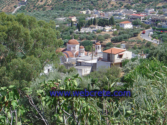
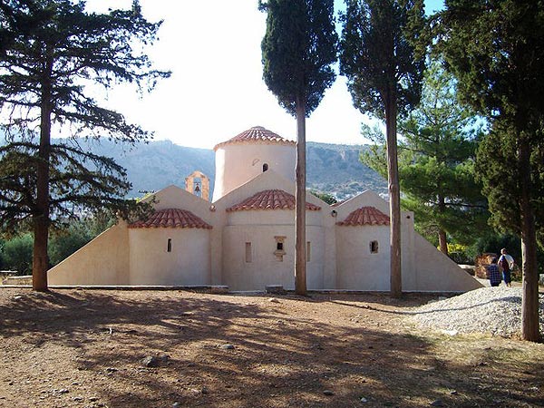
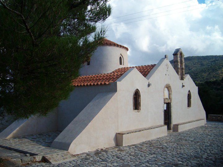
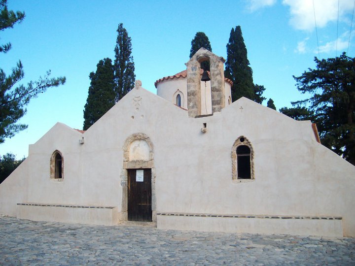
Kritsa has an extensive historic record with evidence of occupation as early as the second millennium BC. Near the village, three km to the north, are the ruins of the ancient Greek city Lato which was noted as one of the most powerful Dorian towns in Crete, with two acropoleis. The oldest setllement in the Kritsa area, on the steep rocky hill south of the village named Kastellos, dates back to the 12–13th century BC (Late Minoan IIIC). Lato is thought to may have been founded when Kastellos was abandoned.[1] Before the entrance of the village is the old Byzantine Church of Panagia Kera with unique, in technique and importance, Byzantine frescoes (13th and 14th century).
Sights and handicrafts
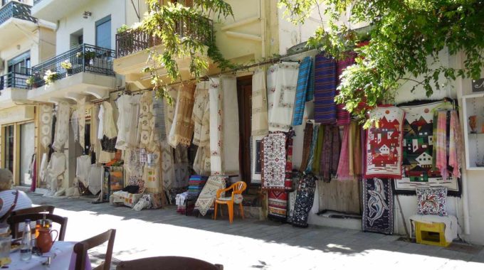
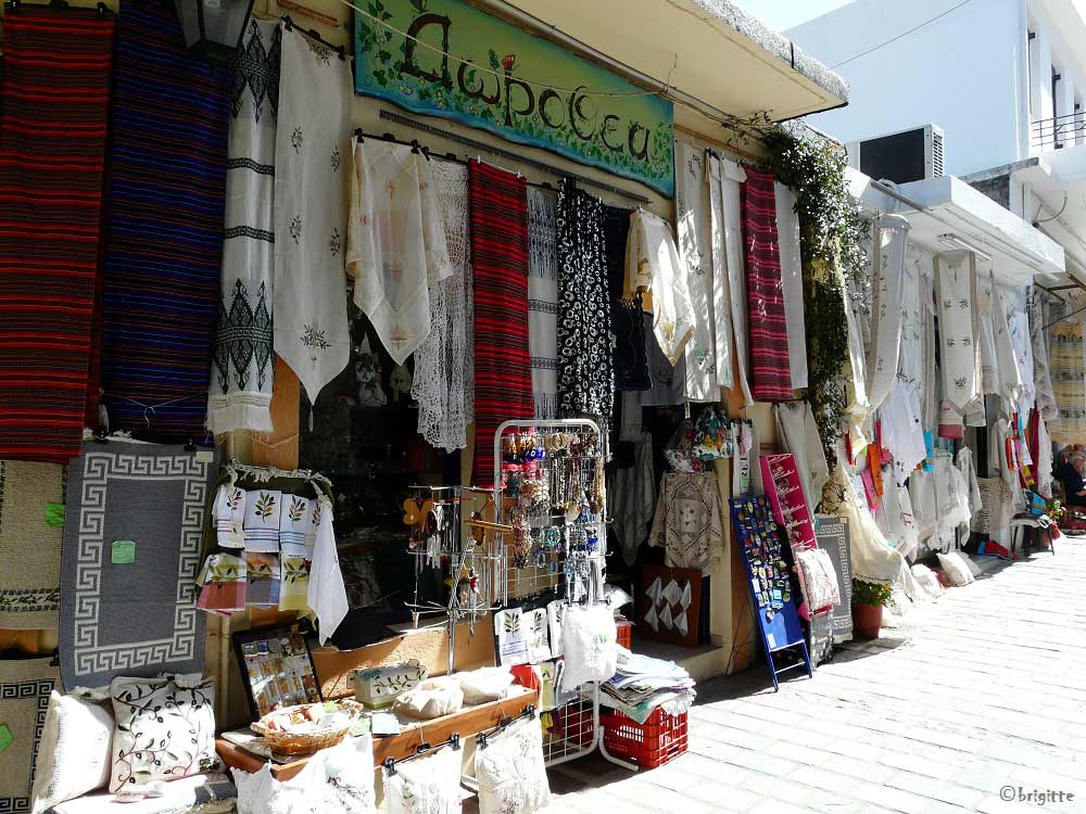
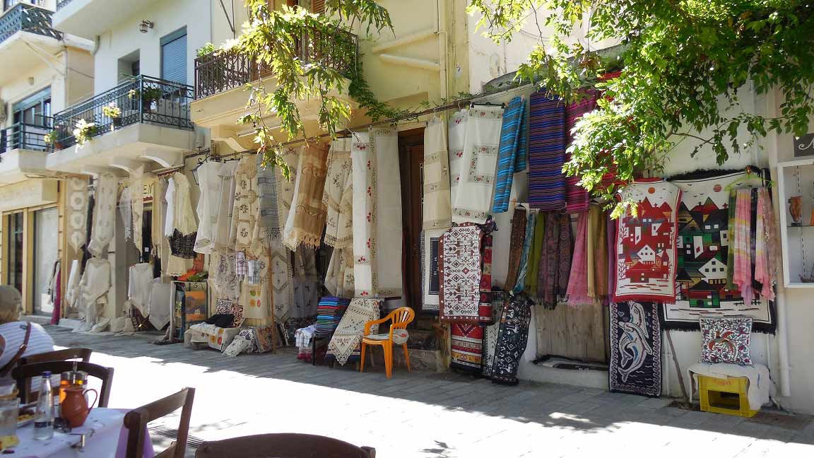
When Kritsa is lit up in the evening it has the form of a scorpion. Old Cretan customs and traditions are kept alive, and Kritsa is considered one of the most important centers of weaving art. The narrow streets are visited by tourists. From Kritsa there is an interesting and spectacular climb to the plateau of Katharo, which provides a panoramic view of Mirabello Bay, Agios Nikolaos and Kalo Horio. The Kritsa Gorge is located on the route to Tapes or to Lato.
Kritsa: The gorge, History and the area
Additional Info
Location: Agios Nikolaos Region – 10 km from Agios Nikolaos – 72 km from Heraklion city
Residents: 2130
Αltitude: 380m for the upper parts and 240m for the lower parts
Access: Asphalt road from Agios Nikolaos
Character of settlement: Settlement with a very intense traditional character
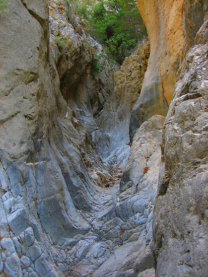
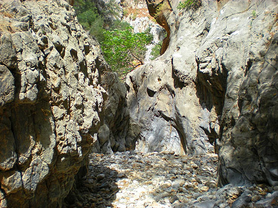
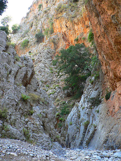
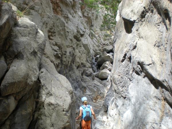
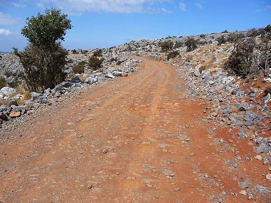
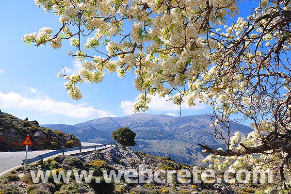
Kritsa gorge is a famous hiking area in East Crete. It is a narrow gorge not far from the town-village of Kritsa and 10 km west of Agios Nikolaos. Just before the village of Kritsa the road curves to the right in the direction of the Lato archeological site and to the gorge. Half kilometer further on is the parking place. It is a nice and not a difficult walk, sometimes need some „rock climbing”. Walking till the gorge area is about one hour. The length of the gorge is 6.5 kilometres. Difference in altitude is 200 metres. Average time of walking is between 2.5 and 3 hours. The first half is not too difficult but after 3 kilometres it gets really adventurous. The rocks get bigger and you climb or slide down.
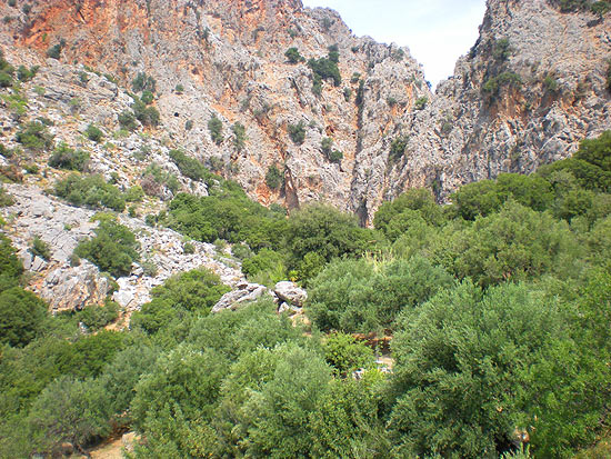
The last part is the most beautiful. The walls get higher and higher and the corridors get smaller. The most narrow part we pass is only 1 metre wide !!! After 1 – 1,5 hour walking is the place where you can decide either to continue hiking in the gorge, turn back or climb up to a path that leads away from the gorge. Returning along the gorge is easy and it takes about one hour. If you want to climb up from the gorge there is a path that takes you close to an ancient Doric village, Lato, which is a historically significant place. If you decide to continue hiking to the end point of the gorge it takes about one and a half hours more. The gorge is quite well marked and only in one place the path veers away from the bottom of the gorge up to a forest and among olive trees.
A reason for this is the piles of stones on the path that are hard to climb over, but it is only a few hundred metres walk. After that the path takes back to the bottom of the gorge where there are a few shortcuts across some curves just to make walking easier. After two hours walk the gorge opens to a wide valley and on its slopes there are olive groves. Only in a couple of places it takes some time to find the right direction but there are red arrows and piles of stones, that hikers have made, showing the right route. Kritsa is one of the oldest and most picturesque villages in Crete, at an altitude of 375 m. During the Middle Ages, it was thought to be the largest village in Crete. Kritsa has an extensive historic record with evidence of occupation as early as the second millennium BC.
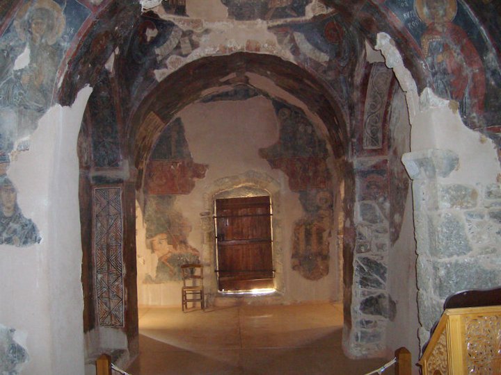
Panagia Kera Church is located on the way from Agios Nikolaos to Kritsa village. It is 9km far from Agios Nikolaos city and 800m east from Kritsa. This triple-nave Byzantine church is dedicated to the Assumption of the Virgin Mary, to Saint Anthony and Saint Anna. It is adorned with superb wall paintings on particular themes like the representation of Saint Anna, other icons of the saints, and the fourteen scenes depicting the secret life of the Virgin Mary.
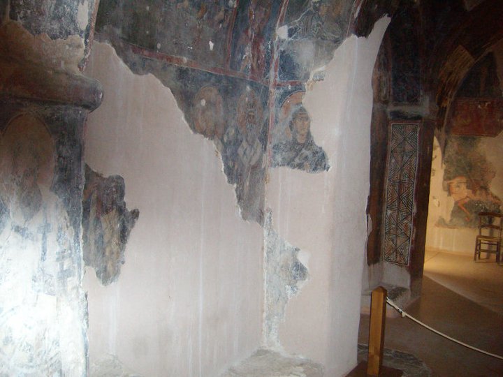
Characteristic of all the wall paintings is their vividness, expressiveness and aesthetic perfection. Their existence had been hidden for hundreds of years by earlier Christians to avoid their destruction by the Turkish occupiers. It also has three aisles and a dome construction. Each aisle contains paintings from a different period, representing a different religious theme.
The central aisle, dedicated to the Assumption of the Virgin, contains the oldest paintings which reflect a mixture of styles. The other two aisles were added on in later periods. The south aisle has the best-preserved paintings. In contrast to the more stylized paintings of the period, these paintings display a tenderness and humanity in their rendering of the story of Anna, the Virgin Mary’s mother. The north aisle is dedicated to St. Anthony and has pictures representing the Second Coming. Although the Venetians occupied Crete during the period, they allowed the Cretans to decorate their churches as they desired. The rare fresco techniques used and the subject matters make the Panagia Kera particularly interesting to visit.
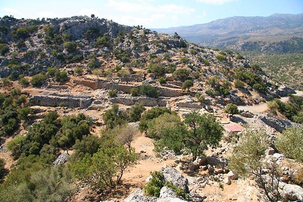
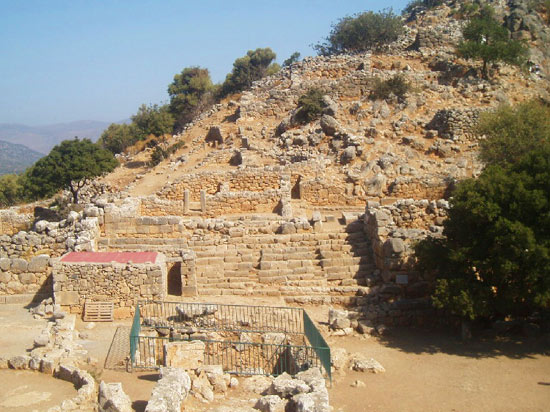
Lato was one of the most important Doric city-states in Crete, although it must have existed before the “Coming of the Dorians”. It is built on a saddle between two hills, at a site protected by possible attacks but also with a splendid view over a large area of the Mirambello Bay. It is possibly mentioned in the Linear B tablets as RA-TO. It was named after Leto (Lato is the Doric type), mother of Apollo and Artemis, although the main goddess worshipped in the city was Eileithyia, who was also depicted on the coins cut by the city. Lato was the birth-place of Nearchos, the admiral of Alexander the Great. Before the end of the 3rd century B.C., the inhabitants of Lato participated in the League of the Cretan cities and shared the same laws.
Lato made many alliances with Rhodes, Teos, and king Eumenes of Pergamon. However, it was in continuous conflict with the neighbouring city of Olous, for the arrangement of the borders between them. The harbour of the city was Lato pros Kamara (modern Aghios Nikolaos), which was so flourishing by the middle of the 2nd century A.D. that the administrative centre was transferred there and Lato was subsequently abandoned.
The English admiral Th. Spratt, in his work “Travels in Crete”, published in 1865, mentions that he located the remains of the ancient city on the hill of Goulas, but wrongly identified them as the remains of Olous or Oleros. The archaeologists F. Halbherr, L. Mariani and A. Taramelli, visited the site and identified it as ancient Lato. In 1894-96, A. Evans conducted a small-scale investigation. Systematic excavation started in 1899-1901 by the French School of Archaeology, with J. Demargne, was resumed in 1968 by P. Ducrey, O. Picard, and B. Chatzimichali, and lasted until the 1970s.
The most important monuments of the site are:
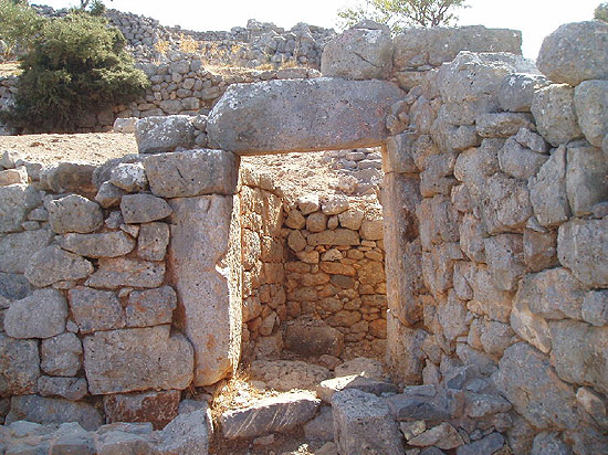
The fortified city on the saddle between two hills. It had a steep double acropolis with fortification walls. The main gate had three successive entrances and two internal square courtyards so as to control the incoming. At this point started a street with almost eighty steps, which led up to the Agora. On its north side was a wall with towers, and private houses built on successive terraces, so that the roof of the lower ones was the actually the court and the way of access to the upper ones. These houses and others in the area of the north acropolis were simple in plan, usually with two square rooms having a hearth at the centre. Subterranean cisterns, cut in the rock were used for the collection of rain water for the needs of the household.
Industrial workshops, such as an interesting dyehouse were located on the south side of the street.
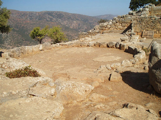
The “Agora” is an open space, including a deep square cistern, once roofed, and a small rectangular temple without columns, with a single chamber, probably unroofed, where many figurines of the 6th century B.C. were found.
A rectangular platform with two steps, partly cut in the rock, is located to the south of the “Agora”.
A Doric stoa with a step on three of its sides was built to the west.
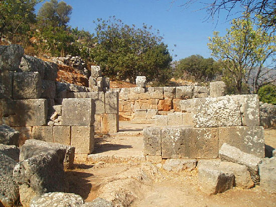
The Prytaneion. A monumental complex, reminiscent of an ancient theatre, lies in the north: seven tiers are divided by narrow staircases into three wings, seating almost eighty persons. It was probably used for public discussions or for watching spectacles, but at the same time the steps led to the upper terrace, where, through a peristyle court and a narrow doorway, one could enter the actual “Prytaneion”. Two high retaining towers, built of large blocks, surrounded the building and supported the one lying at a higher level. In the central room of the Prytaneion there was an “eschara” (hearth) burning day and night, surrounded by two-stepped benches, each seating eight persons. This was the place where the “kosmioi”, the notables of the city dined and held their meetings. Two rooms to the north housed the archives of the city.
The Temple. To the south of the “Agora”, on a terrace supported by a retaining wall, are preserved the ruins of the city’s large temple (measuring 10 x 16 m.), which comprises a square sekos (cella) – where the base of the deity’s cult statue was found in situ, with an illegible inscription – and a rectangular prodomos (antechamber). An altar with two steps lies in front of the temple.
To the east of the temple, at a lower level, there was a “theatral area” with steps partly built and partly cut in the rock, with a seating capacity of 350 persons. Beside it lies an exedra, while another platform formed the skene (stage), with an altar to the west.
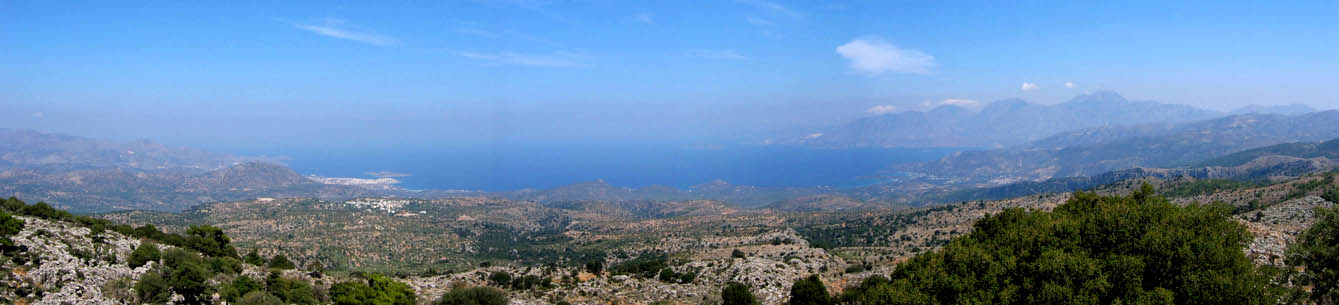
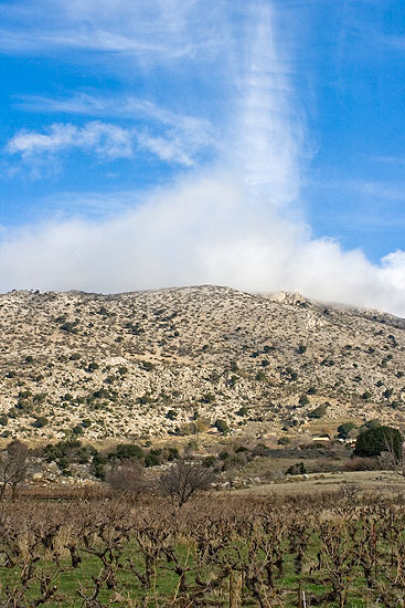
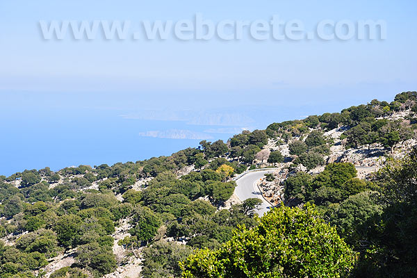
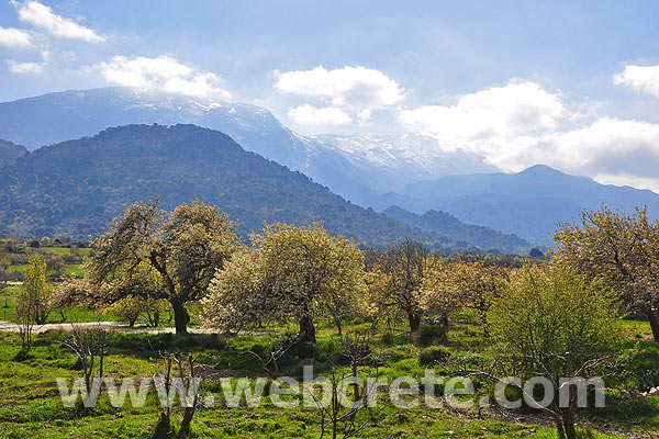
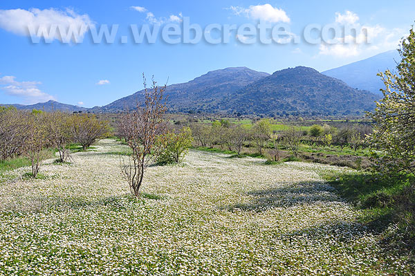
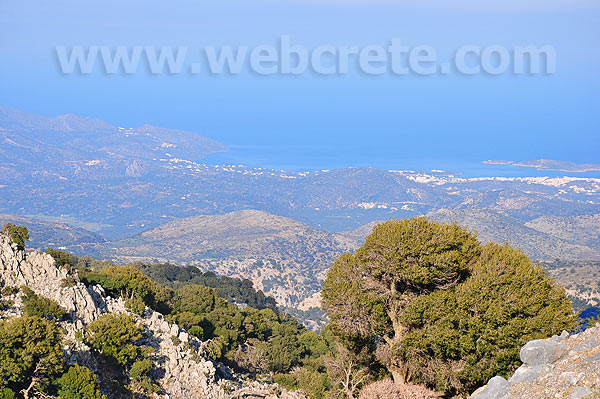
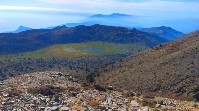
The plateau of Katharo is located at an altitude of 1150 meters and it is 16km from Kritsa, 26 km from Agios Nikolaos and 12 km east from the plateau of Lassithi.
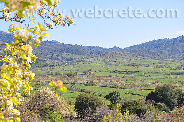
We drive through Kritsa village over a sometimes narrow little road.When the tarmac ends we drive on for a little bit and park our car near a small church onthe plateau. We look around us and see all the colours of the rainbow! A large diversity of flowers covers the Katharo plain. The Katharo plateau is much smaller than the Lasithi plateau, but certainly at least as beautiful! For who wants to go there, park your car at the church and just follow the trail for a bit. A plateau full of flowers which is not too touristic…
In Katharo there are a few houses but there are no permanent residents. Its seasonal residents are shepherds, who also produce small quantities of vegetables (potatoes) and fruit (grapes, apples) for their own needs only. The electricity here is produced by generators. In Katharo there is a very unusual arrangement concerning the ownership of land. All land belongs to the community of Kritsa and the authorities allow the residents of Katharo to use it. In return, four percent of what they produce has to be paid to Kritsa each year.
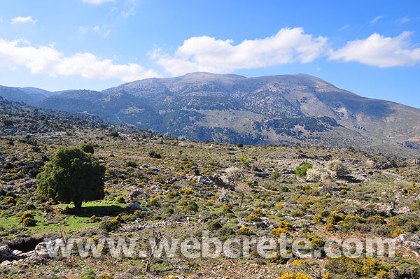
The cypress wood of Kritsa is located about 10km west of Kritsa village, very close to the asphalt road that heads to the plateau of Katharo. It is formed across a deep ravine, at the southern foot of Mount Tsiva. The forest is in the middle of the ancient path that led Minoans to the plateau of Katharo, with many Minoan pottery remains found here.
The kernel of the forest is covered by cypress trees, and its surrounding vegetation consists of cypress, oak, maple, holly, wild olive and holm oak trees. Today, the wood can be accessed very easily because the nearest trail starts from the road and ends after 30 minutes of easy walking in the wood. The starting point of the path is located at position Favetoprinos, where there is an information kiosk and several benches with spectacular views of the wood and the Tsiva Mountain. The kiosk has a detailed map of the local trails and the area attractions (caves, archaeological sites, springs, etc).
During hiking, someone will meet abandoned sheepfolds, which indicate the old use of the area by shepherds. Unfortunately, even today, the goats are still roaming in the area and destroy all the undergrowth and small trees, which results in the continuous degradation of the forest. Protecting the last of cypress grove of Dikti Range must be placed in the center of the ecological acts in Lassithi, so as this area does not follow the fate of the extinct cypress forests in Crete.
After walking in the path surrounded by thymeland and crossing the paths heading to Katharo Plateau, you will end up in the woods after some time. Near the forest you can visit the cave “Englishman’s Cave”, where some Englishmen were hiding during the Second World War.
Several centuries ago, Crete was covered by dense forests of cypress, which unfortunately do not exist today. The cypress of Crete was famous throughout the world since the Minoan period, when the timber was one of the major trading products. Indeed, Crete was known as the land of cypress, just like Lebanon is known today as the land of cedar. Over-logging turned the forest to bare mountains and today a limited number of areas with cypress trees remind of the past. It is noteworthy to mention that the forest of Kritsa is the last of its kind in eastern Crete and there are only two similar woods in the White Mountains. The cypress species of Kritsa is known in Crete as female cypress or the Cypress tree of Minos. It is a tree that reaches a height of 30 meters, has high and horizontal branches and rich foliage.
Source: http://www.cretanbeaches.com
Kroustas is a small traditional village close to Kritsa village on the island of Crete. It is located on a hill 480 m above the sea level. In the year 2001 the village had around 500 inhabitants.
Kroustas is known for its magnificent view of Mirabello Bay. It is also known for its traditional cuisine including myzithropites (special cheese pies), ftazymo bread and aiga vrasti (boiled goat).
In the past people of Kroustas were shepherds and land workers. However, nowadays, following the booming of the tourist industry in east Crete, most of the village people work in the nearby resorts of Agios Nikolaos and Elounda.
Characteristic of Kroustas is the smell of Raki distillery in October, the dry but cool summers, the dry and rocky landscape and the old ladies with the black scarfs and the wrinkled faces. What could you buy from Kroustas? Pure food like honey, almonds, walnuts, myzithra (soft sour cheese) and raki (locally distilled spirit).
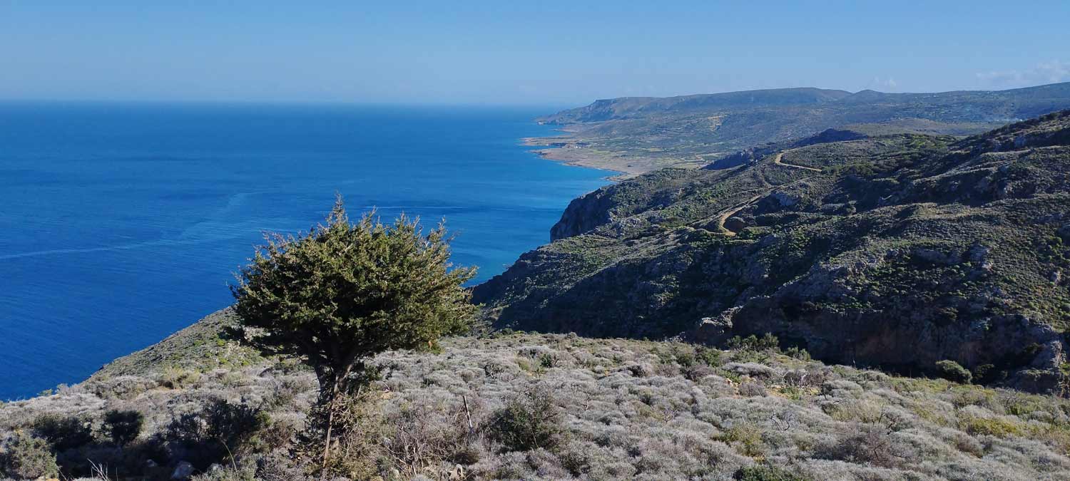
A relatively small but impressive gorge with many changes in its landscape is the unknown…
Kritsa is one of the oldest and most picturesque villages in Crete, Greece, built amphitheatrically…
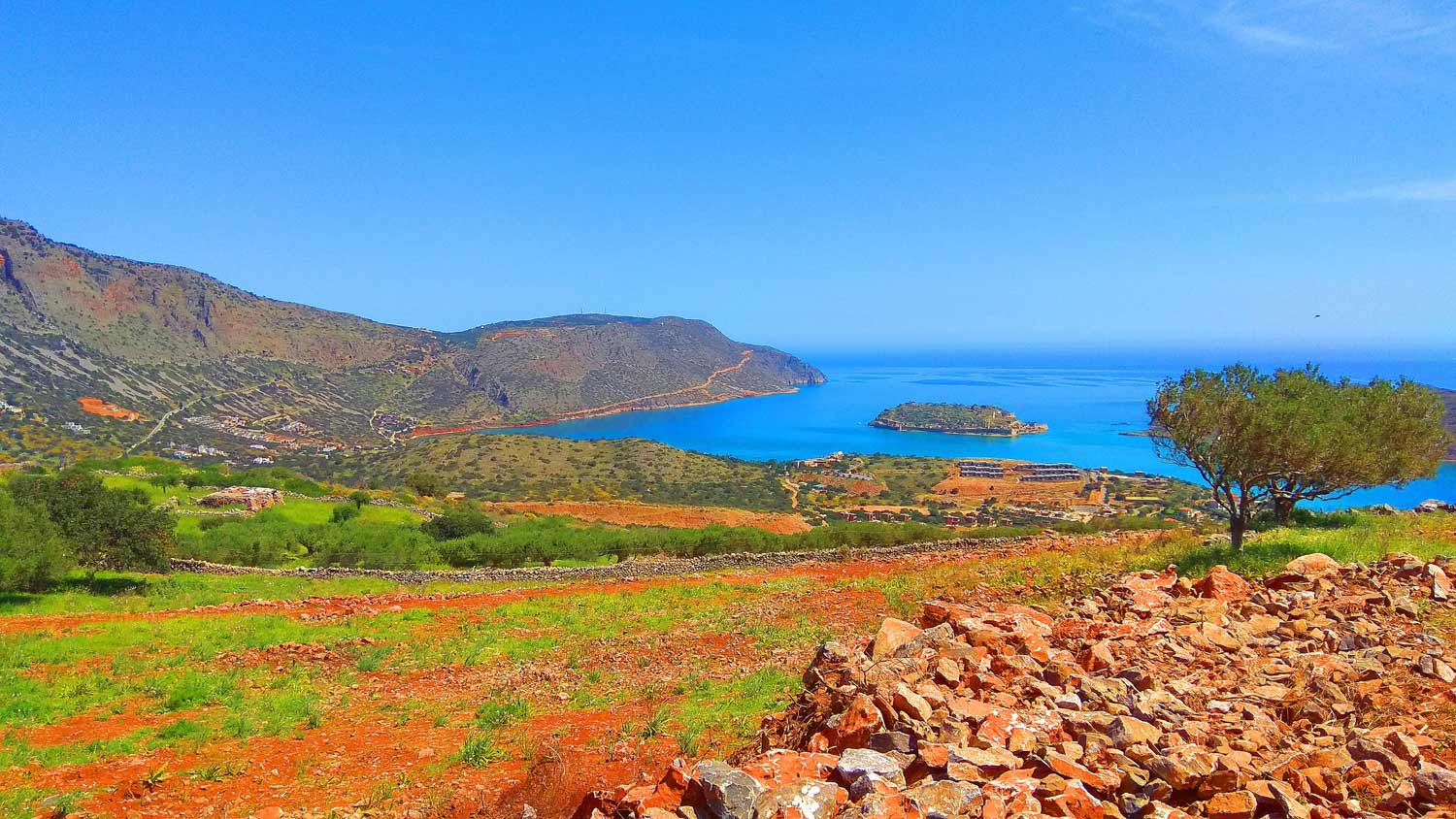
We start from Elounda village by car and head west towards the village of Pines.…
Related Articles
Driving into the historic village of Kritsa was a neat experience. It is a small village of white buildings and houses spread throughout a hillside of the Dikti Mountains with Kritsa Gorge visible off to the right. We found the parking area, gathered up our packs, and headed down a set of stone stairs into the wash of the gorge. Kritsa Gorge started with some boulder climbs and navigation around small obstacles. I could immediately feel and see the difference between Kritsa Gorge and the canyons I was used to hiking back home. The wash, boulders, and dry falls might have seemed to be the same, but nothing else.
The plants and trees were completely different, especially hiking in the midst of olive groves. Also, the sounds were different. Instead of the sound of either silence or small birds such as canyon wrens, there was the constant buzzing noise of insects that I had not heard before. Being the end of August, it was still very hot on Crete and as we headed up canyon, we were taking frequent rest breaks in shade to drink water. We soon entered the Kritsa Gorge narrows, which were shallow but spectacular. There was one tricky part where we had to get past a nest of wasps or hornets in the narrows without getting stung. After getting some nice pictures in the narrows, we continued up canyon past the first exit point of the gorge.
The first exit point allows you to loop hike back to the car by way of old dirt roads and trails above the gorge. Through the middle portion of Kritsa Gorge, we passed by more olive groves and were introduced to the Cretan wild goats. The true Cretan wild goats (also known as Kri-kri or Agrimi) are found over in the White Mountains and Samaria Gorge area, and I got some nice pictures of them. The wild goats we saw in both Kritsa Gorge and Sarakina Gorge were more likely domestic runaways. While proceeding up Kritsa Gorge, it is actually necessary to open and close several gates which help control the grazing areas of these goats. As our hike continued, the canyon walls disappeared and we were hiking in a shallow wash with nice views of the surrounding hills. We then reached the turn-off point for the village of Tapes and turned around. Tapes is an extended hiking destination for those who want to see an interesting traditional Greek village.
On the way back down Kritsa Gorge, we turned off and took the first exit point back to the car, which allowed us to have some nice views of Kritsa village and the surrounding area. Our hike of Kritsa Gorge had proved to be an outstanding introduction to gorge hiking on Crete. That evening, I picked up a bottle of Kritsa’s award-winning olive oil to pour over our Greek salads after we finished swimming in the Cretan Sea at Faedra Beach. It was so good that we took some Kritsa olive oil with us to enjoy during the rest of our trip. Our hike took place on August 31, 2014.