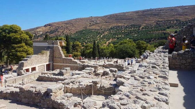
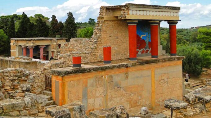
Expanding on the initial overview, the archaeological site of Knossos is a complex palatial city…
Minoan settlement of Kastro
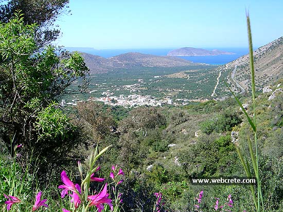
Kavousi Kastro is an archaeological site in eastern Crete, about 5km (or 16 km through Melisses and Tsamandis village) southeast of the modern village of Kavousi, a historic village in the municipality of Ierapetra in the prefecture of Lasithi.
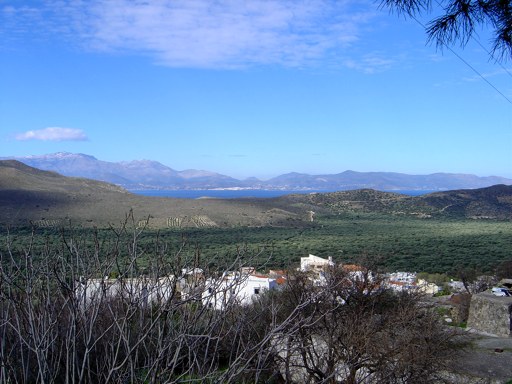
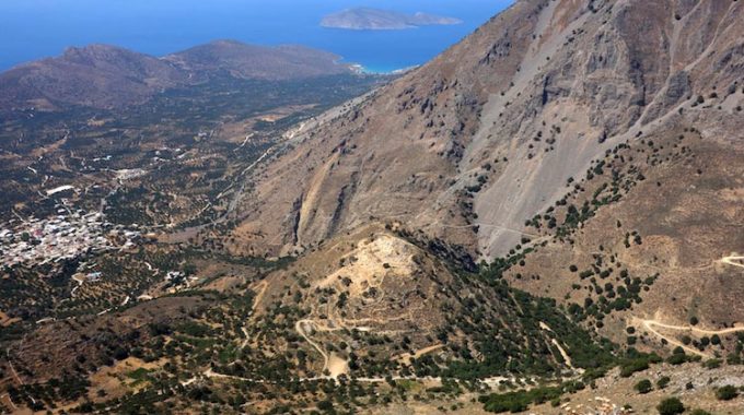
Situated on a steep and rocky peak at an elevation of 713 m above sea level in the northern foothills of the Thripti Mountains, the site overlooks the Gulf of Mirabello and the northern Isthmus of Ierapetra. “Kastro” (“Citadel“ or “Castle”) is a local toponym; the ancient name of the site is unknown. The Kastro is best known as a defensible “refuge” settlement of the “Greek Dark Ages”, inhabited from the early 12th to the mid-7th centuries BCE. Most of the visible architectural remains on the site belong to the Late Geometric–Early Orientalizing phases of occupation (8th to 7th centuries BCE)
History of the site
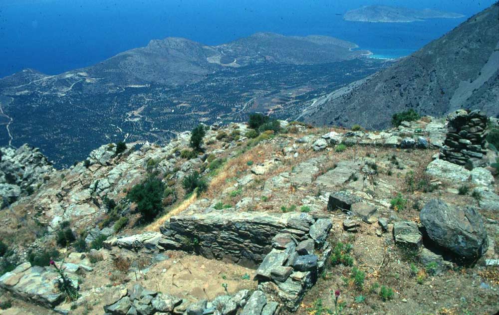 Investigations by the Kavousi Project have demonstrated that a settlement on the Kastro was occupied continuously from its foundation early in the Late Minoan IIIC period (12th century BCE), through the Protogeometric (10th century BCE), Geometric (9th-8th centuries BCE) and Orientalizing (7th century BCE) periods, after which the site was abandoned. Its long sequence of continuous occupation and stratified remains of architecture, floor surfaces, fills, and ceramic deposits provide important insights into domestic activities, architecture, and social organization of a community throughout the entire Early Iron Age, but before the transition to larger urban centers in the Archaic period (6th century BCE), such as at nearby Azoria.
Archaeological research
The site was briefly explored in 1900 by the American archaeologist Harriet Boyd [Hawes], who discovered 13 rooms of what she thought was the house of “an early chieftain”, but now interpreted as multiple, separate house complexes spread across several terraces. The Kavousi Project, directed by Geraldine C. Gesell (University of Tennessee), Leslie Preston Day (College of Wooster; later, Wabash College), and William D.E. Coulson (University of Minnesota; later, American School of Classical Studies at Athens), cleaned the site in 1982 in preparation for balloon photography for The Aerial Atlas of Ancient Crete. Additional surveying of the site in 1983 provided positive indications that the settlement was much more extensive than previously thought. Full-scale excavations under the auspices of the American School of Classical Studies at Athens and the 24th Ephorate of Prehistoric and Classical Antiquities of the Greek Archaeological Service, and with permission from the Greek Ministry of Culture, were conducted at both Kavousi Kastro and Kavousi Vronda from 1987–1990 and in 1992, followed by site conservation from 1993 to 1996, and study from 1990 to 2003.
Today, select antiquities discovered by the Kavousi Project at Kastro are on display in the Archaeological Museum of Agios Nikolaos and in the Archaeological Collection of Ierapetra. Other artifacts, excavation notebooks, and original drawings and plans, are housed in the Institute for Aegean Prehistory Study Center for East Crete (INSTAP-SCEC) in Pacheia Ammos in eastern Crete.
Additional Info
Historical Period: Late Minoan IIIC period (c. 1170–1050 BCE)
Location: Kavousi Village – 5km to southeast
Opening Hours: Free to visit anytime
Access: By dirt road and trail through Brondas ancient site: 5 km — For 17 km by non-asphalt road through Melisses -Tsamandis villages
Entrance Fee: Free – Not organized site
Kavousi: The history and the area
The Late Minoan settlement of Vrondas is located just 1 km west of Kastro settlement and is connected with Kastro by an old Minoan trail which is used today by the hikers who visit the plateau and village of Thripti.
Vrondas Ancient site
Vrondas by Kavousi village, is an archaeological site in eastern Crete, Greece, located about 3.50 km south of the modern…
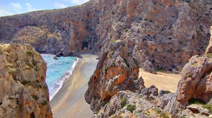
Enjoy by walking some of the most exciting seascapes and Mountain view in Kavousi, covering almost all blue hues of the color palette..
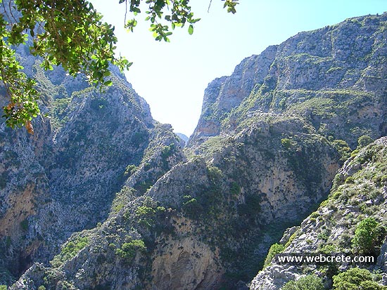
Kavousi-Mesonas Gorge-Thripti
This route which we recommend is one of the most exciting hikes in eastern Crete . A good physical condition…
Thripti village and the plateau (830m) is between Kavousi and Ierapetra and you can drive here on a dirt road from Kato Horio (Ierapetra region). Alternatively you can take from Kavousi the dirt road to east and after 7km t(by Melises village), you turn to south (See the map below for this 17 km non asphalt route).
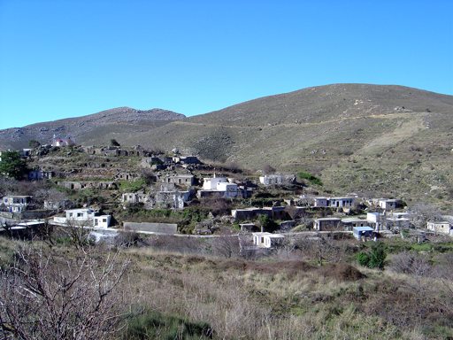
Thripti Village
More mountain climbing to go through unpaved road to an old and current mountain retreat, where excellent grape varieties produce…
Related Articles
This Post Has 0 Comments