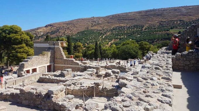
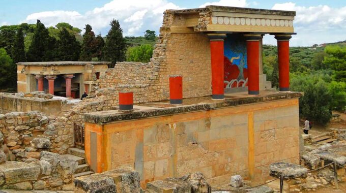
Expanding on the initial overview, the archaeological site of Knossos is a complex palatial city…
Kavousi
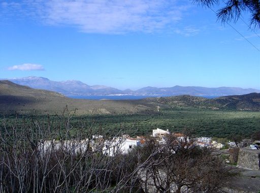
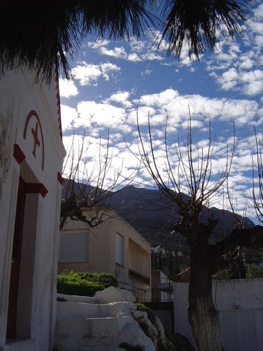
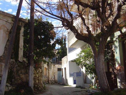
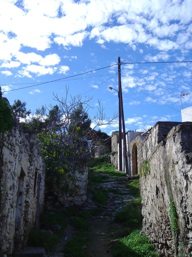
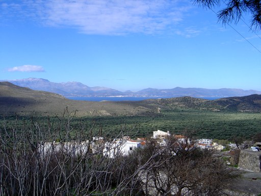
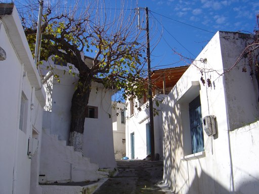
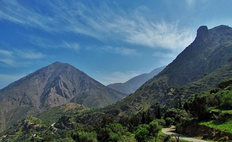
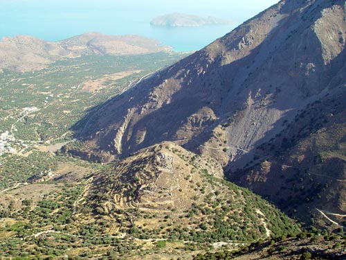
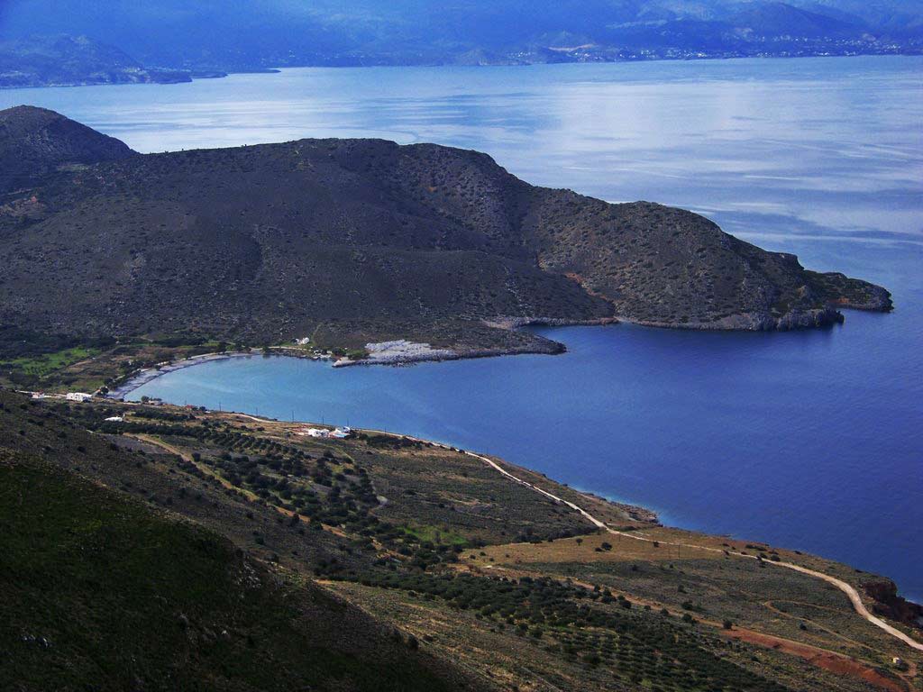
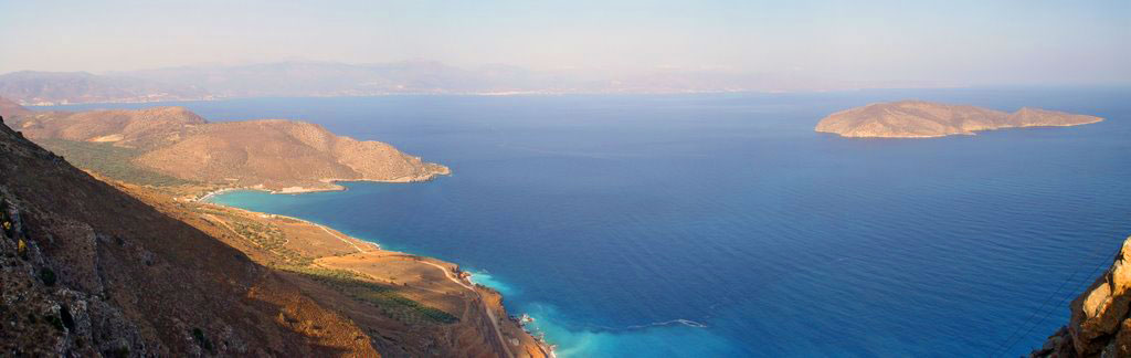
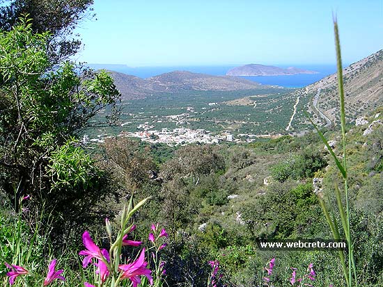
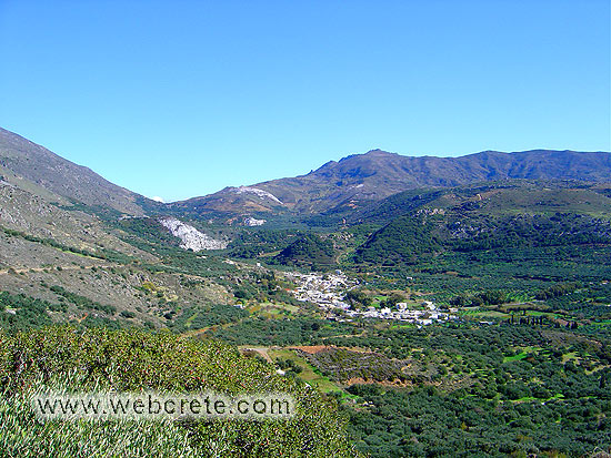
It is built at the foot of two imposing mountains and it is one of the most interesting villages in Ierapetra. At an altitude of 140 meters with a view of the planted all over with olive trees flatland and the waters of the Cretan Sea, Kavousi is a historic and really lively village that offers many activities and sights.
The exact etymology of its name remains unknown; however in the Cretan dialect it describes a small hole, a trough where water is gathered. The first historical registration with this name seems to have taken place in 1577, but the area has been being inhabited for thousands of years and this is obvious by the number of the Minoan settlements and rare ecclesiastical monuments that have been discovered in its surrounding area.
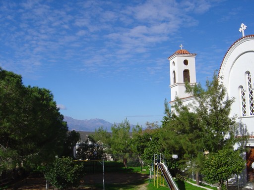
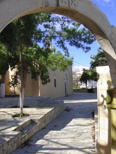
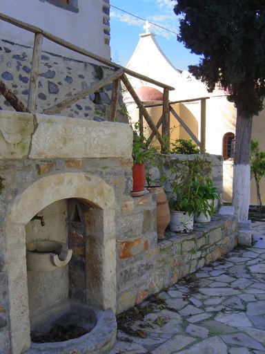
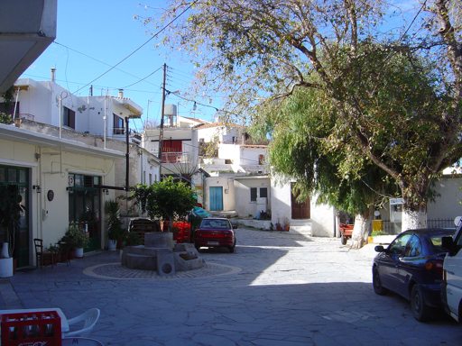
The square with the traditional coffeehouses at the center of the village is a reference point and at a small distance there are the churches of Saint Georgios and Twelve Apostles that are worth your attention.
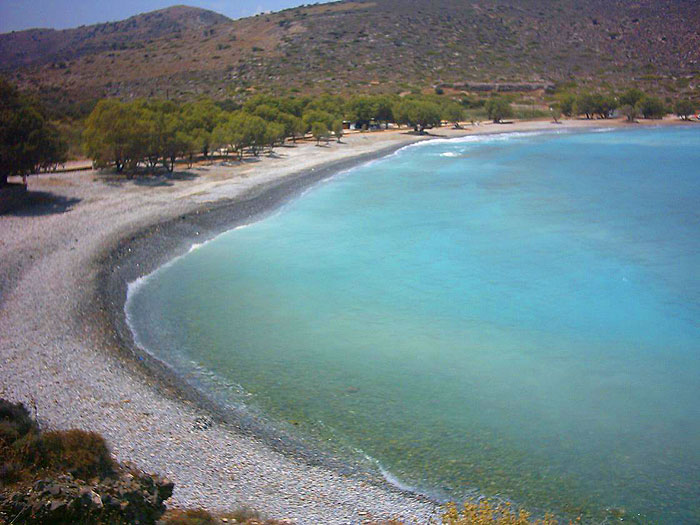
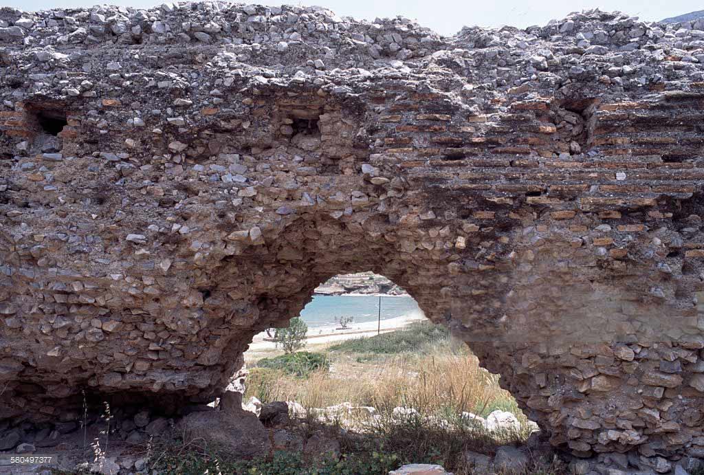
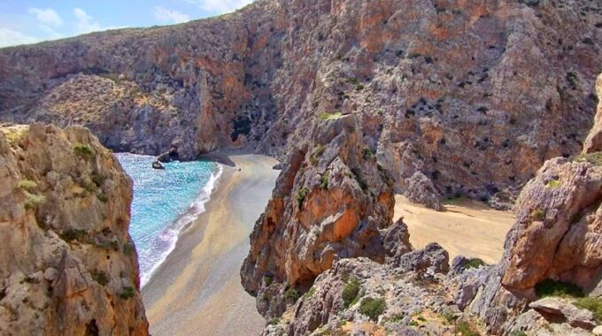
 Just 3 kilometers from the center of the village there is the beach of Tholo. The sandy beach with the shallow waters and the tamarisks creates the ideal circumstances for carefree holidays. There will be also evidence found about the age of the history of the village. The ruins of the Roman warehouses stand imposing next to the bathers in the summer, and after a short walk you will find the remarkable chapel of Agios Antonios with its wall paintings.
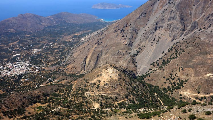
Opposite, Psira can be seen; an island that thousands of years ago formed a basic part of the Minoan civilization with a big port and a big city that were discovered in the beginning of the previous century. The only shipwreck of the Minoan era that has been found until today was there in 2006. The view of the island –and the whole bay of Mirambello- from the area of Platanos, on the east of the village, is very impressive.
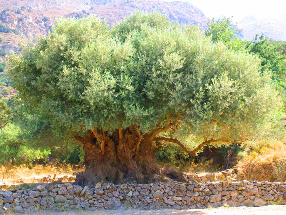
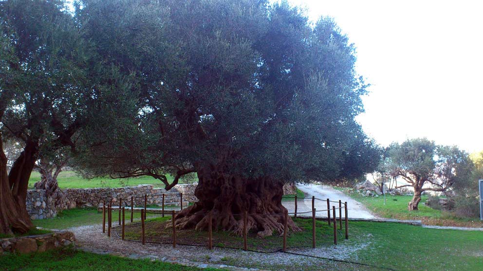
Ascending towards the mountain of Afendis, we can see another great historical monument; an ancient and extremely impressive olive tree, almost 3.500 years old, with a huge trunk the diameter of which is more than 20 meters. It is one of the oldest trees in the world that has been declared a protected monument because of its adjacency with the Minoan settlements as well.
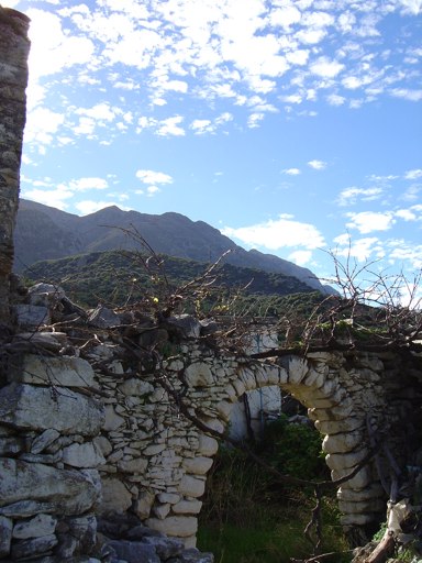
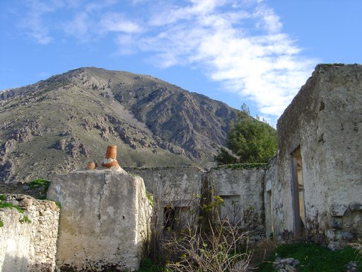
The settlements of Avgos, Tsamantis and Drakalevri are the ones that are found next. They are now an excursion destination for the people of Kavousi, however they hide memories of difficult periods since many were those who used to seek for a cover in the rutty peaks.
Additional Info
Location: Ierapetra Region – 19,8 km far from Ierapetra – 28 km from Agios Nikolaos
Access: Asphalt road
Residents: 653 (2017)
Αltitude: 120m
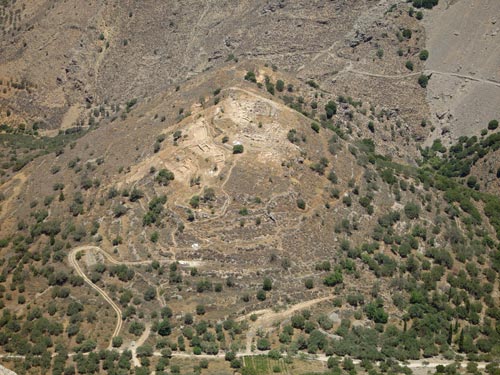
Azoria archaeological site
Azoria is an archaeological site on a double-peaked hill overlooking the Gulf of Mirabello in eastern Crete in the Greek…
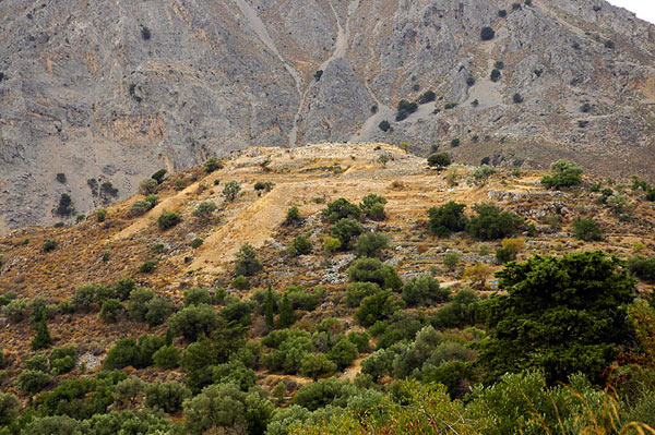
Minoan settlement of Kastro
Kavousi Kastro is an archaeological site in eastern Crete, about 5km (or 16 km through Melisses and Tsamandis village) southeast of…
Vrondas Ancient site
Vrondas by Kavousi village, is an archaeological site in eastern Crete, Greece, located about 3.50 km south of the modern…
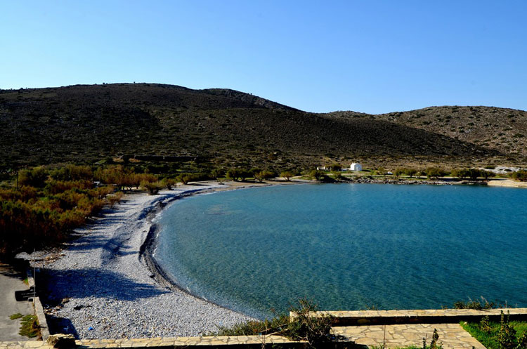
Tholos Beach
Tholos beach is located 29km eastern of Agios Nikolaos, 45 from Sitia, 23km north of Ierapetra and 3km from the…
Chrisopigi – Bebonas – Kavousi
The route Chrisopigi –Bebonas– Kavousi is easy to pass and we walk on a dirt road to the end. The road…
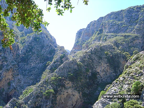
Kavousi-Mesonas Gorge-Thripti
This route which we recommend is one of the most exciting hikes in eastern Crete . A good physical condition…
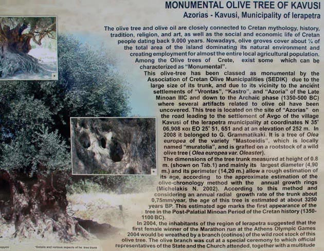
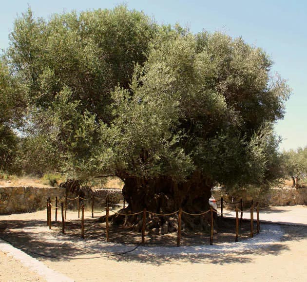
“Monumental” olive tree of Kavousi
This olive-tree has been classed as monumental by the Association of Cretan Olive Municipalities (SEDIK) due to the large size of its trunk, and due to its vicinity to the ancient settlements of “Vrontas”, “Kastro”, and “Azoria” of the Late Minoan IIIC and down to the Archaic phase (1350-500 BC) where several artifacts related to olive oil have been uncovered.
The olive tree is located on the site of “Azorias”, about 2km far from Kavousi village. At the east entrance of Kavousi, take the first left after a small bridge (at the foot of the descent of Platanos) and follow the plates “Old Olive Tree” (at coordinates 35°06’54.78″N – 25°51’40.43″E and at an elevation of 252 m).
It is a tree of Olea Europea of the variety “Mastoidis”, which is locally named “Muratolia”, and is grafted on a rootstock of a wild olive tree (Olea Europea – variety “Oleaster”).
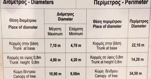
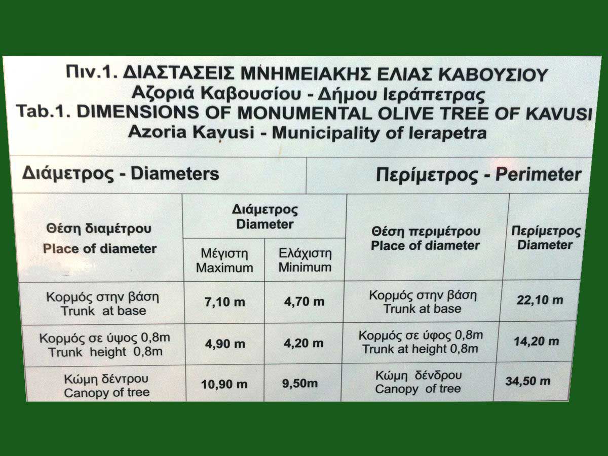
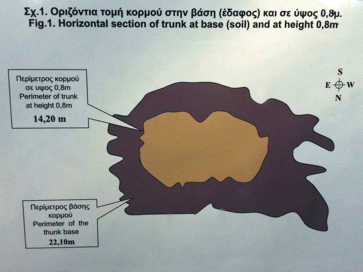
The dimensions of the tree trunk measured at height of 0.8m (shown on Tab.1) and mainly its largest dlameter. (4,90m) and its perimeter (14,20m) allow a rough estimation of its age, according to the approximate estimation of the olive-chronology method with the annual growth rings (Michelakis N. 2002). According to this method and considering an annual radial growth rate of the trunk about considering an annual radial growth rate of the trunk about 0,75mm/year, the age of this tree is estimated at about 3250 years BP. This estimated age marks the first appearance of the tree in the Post-Palatial Minoean Period of the Cretan history (1350-1100 BC).
In 2004, the inhabitants of the region of lerapetra suggested the first female winner of the Marathon run at the Athens Olympic Games 2004 would be wreathed by a special ceremony to which official representatives of the State and the Church at tented, together with many peoples.
The olive tree and olive oil are closely connected to Cretan mythology, history, tradition, religion, and art, as well as the social and economic life of Cretan people dating back 5.000 years. Nowadays, olive groves cover about 1/4 of the total area of the island dominating its natural environment and creating employment for almost the entire local agricultural population.
Agriomandra Beach is an area, unknown to the most, formed at the exit of a short gorge (with the same name: Agriomandra), which the visitor needs to cross in order to access the beach. To get there one should follow the dirt road that crosses the green meadows west of Kavousi, located at the small plateau Lakos Ampelion, to the entrance of the gorge. From there begins a short hike 10 minutes long, not particularly difficult, that leads to Agriomandra beach. Agriomandra originally was used as a port by the Venetians. You can see some of its architectural remains lying around.
Shortly before we reach the beach at the right and left side we see small caves into the rocks. One of these caves is carved with stone and is shaped into a small temple. It was built during Byzantine times by a hermit and is dedicated to St. John the Theologian. There are no functional utensils or icons inside the small temple, but especially during the summer months it becomes the place where religious rituals such as baptisms are made!
The beach of Agriomandra is a sheltered area, well protected by the embrace of the canyon walls, which expand into the sea. Agriomandra is deserted mainly because of difficult access and the place is ideal for isolation. Under the large trees you will find the necessary hospitality and shade you need to enjoy the loneliness and the scenery.
Until 1920 the leeward port was used as a transfer station for animals and other cargo to Agios Nikolaos, as there was no road network in the region. You will see the old customs office and a well, used to pump water. The name of the beach is associated with a Cretan meaning of the word “mandra” (paddock), which refers to open areas where animals are gathered to be loaded on ships. On that beach, due to the gorge’s walls that functioned as natural barriers, the animals were easily controlled and loaded on the ships for their transportation.
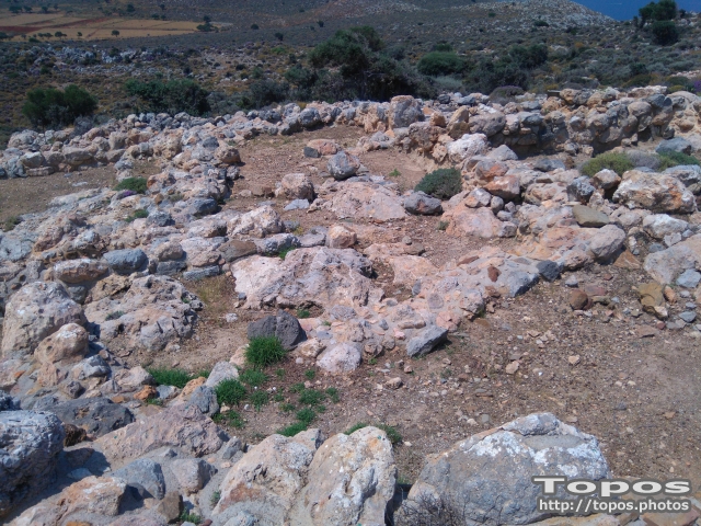
The Minoan farmhouse at the southern end of the hill of Chomatas was first occupied in the late Minoan IB period and then rebuilt and expanded in the late Minoan IIIA2-IIIB phases (ca.1500-1300 B.C.).
The original building had five rooms. The latest phase of the house had 15 roomsand a large open courtyard. The finds from the building indicate routine domestic activities, as well as evidence for farming, animal husbandry, and food processing. Artifacts indicating weaving and ritual activities were found as well. In the latest phase of the house, one room contained a conical cup, ladle, a triton shell and two pairs of goat horns displayed on a raised surfacein a bedrock crevice, suggesting a small domestic shrine.

The house at Chomatas, excavated in 1996 and 1997, is one of many Minoan farmsteads and rural houses that once occupied the Kampos plain of Kavousi. This example provides details of the daily life of the occupants of a rural house of the late bronze age, as well as important information on the agricultural economy of Minoan Crete.

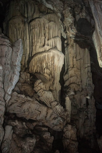 Theriospilios is a small cave in the position Chyloftes – Therio, northwest of Kavoussi in an altitude of 50m, on a steep slope above the sea. Visitors can reach the cave from Kavousi after walking 40 minutes. Theriospilios has a total length of 44m, 25m maximum width and height 0,5 – 7m.
After the entrance of the cave, the visitor enters a low hall with dimensions 7m x 8m. The following room is spectacular, with 37m length, 25m width and 1.6-7m height, with sloping floor. It is richly decorated and gives the visitor an excellent impression.
Small and large columns are scattered everywhere. Bands from stalagmites shape an excellent complex. A white high stalagmite is magnificent. Two stalagmites have been broken; the one is laid on the floor and the other one is inclined.
This phenomenon is rare and has caused the interest of cavers. The far left of the hall is a blocked cesspool, from which water flowed when the cavern was a river bed.
Related Articles
This Post Has 0 Comments