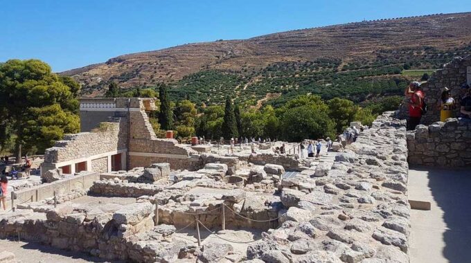
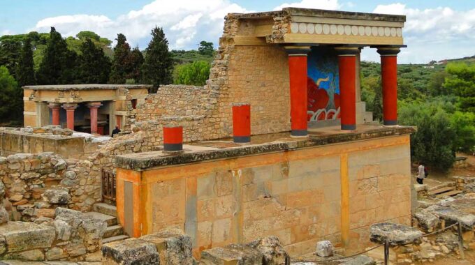
Expanding on the initial overview, the archaeological site of Knossos is a complex palatial city…
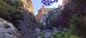
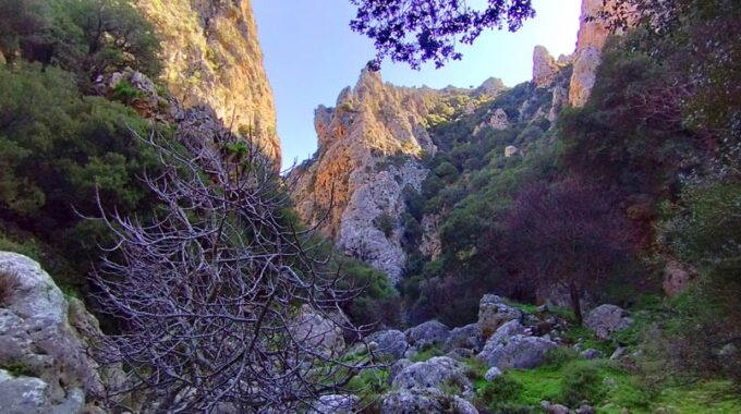
Havgas Gorge, Elounda
We start from Elounda village by car and head west towards the village of Pines. An excellent route through picturesque small settlements, the narrow asphalt takes us back several years since the images we see contain traditional rural Crete, although we are so close to Elounda. We are only 15 km away from Agios Nikolaos and shortly after Pine and on top of the hill we admire the Mylotopi of the settlement, i.e. the mills in a row on the hillside, an indication that in the past it was very windy here and the motive power of the wind was used by the inhabitants in grinding the grain. Many mills are in good condition and restored.
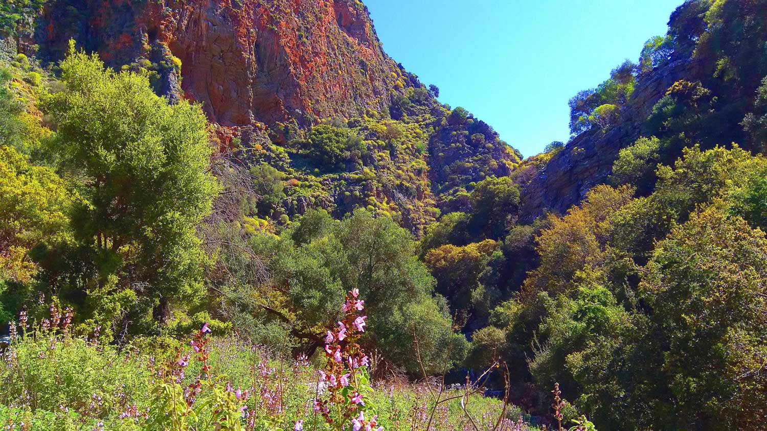
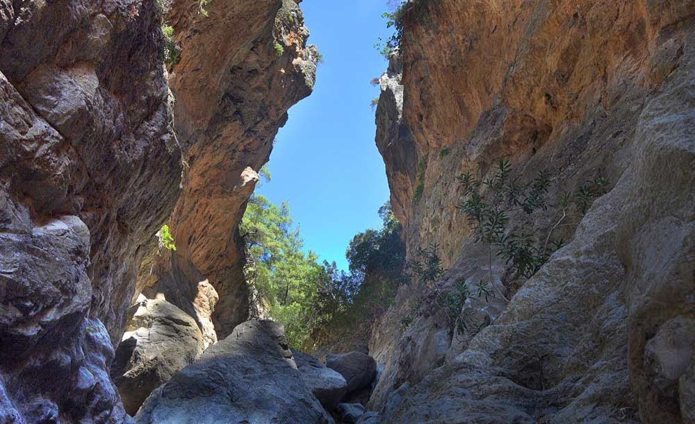
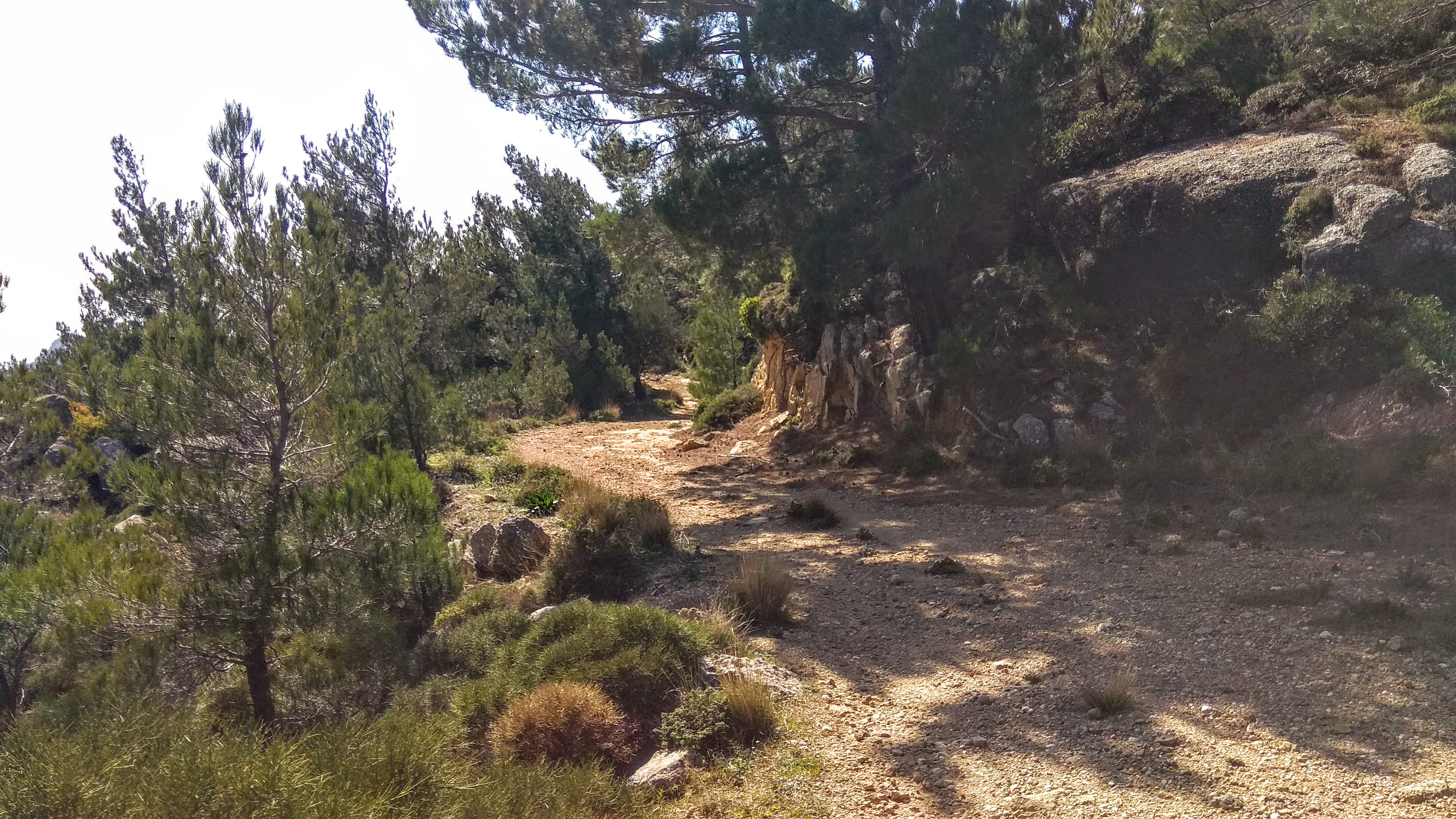
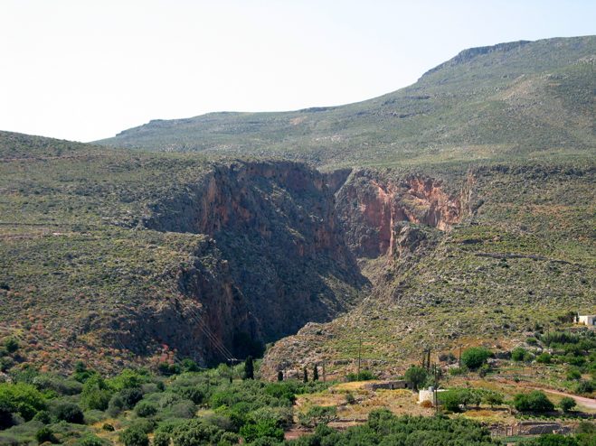
We continue for another 1 km on the asphalt and at a small intersection we turn right onto a dirt road for about 700 meters where we park on the edge and now go down on foot to a secondary dirt road that leads us into the canyon. Moving into the canyon, the vegetation is denser and you often have to be careful of branches that get in the way. Unfortunately, today this historic route needs some maintenance, as it has been taken over by low vegetation as well. Nevertheless, we will not describe it as dangerous as the stone-built path inside the canyon bed is impressive
At these points before we enter the gorge, we observe old elaborate stone structures where our ancestors with great effort and teamwork produced lime, a material necessary for plastering the houses, but also for hygiene. The production took place in the summer, because the fire they lit around the furnaces had to simmer for a long time and no rain would fall, put it out and the effort would go to waste. The furnaces were located next to places that had stones, but also wood for the fire, while the people involved slept around doing shifts, so that the fire would not go out. A process that took days! Here the rock caves and the stone enclosures around them are impressive.
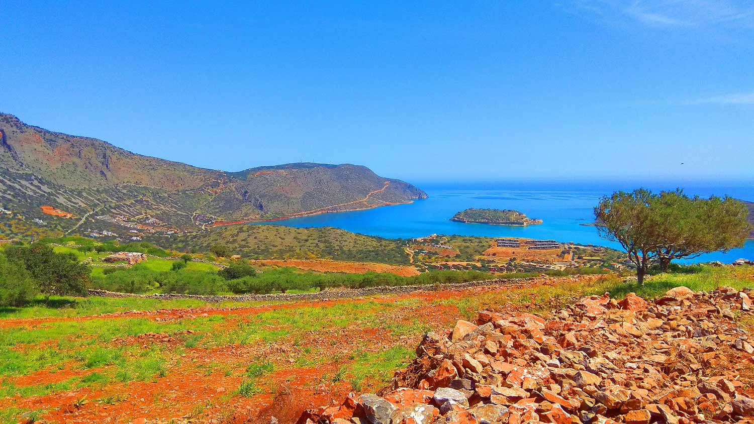
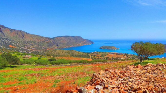
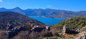
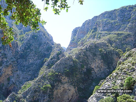
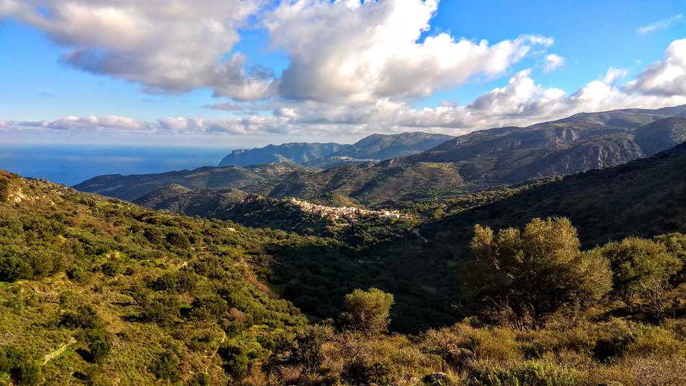
Following the bed of the canyon, we pass under the settlement of Haugas and after two hours of walking we come out just before Plaka of Elounda, where we meet our first modern herd. No matter how touristy an area is, the shepherds and their animals always remind us that we are in Crete. Here we will not go down to the tourist village, but we will take the uphill road in a southerly direction to return to our starting point from a rural road that in 2023 was asphalted all the way to the settlement of Pines. The view from here first to Spinalonga and then to the fissure and the channel of Elounda is magnificent.
The way back:
From this point we go up the now narrow asphalt road, heading south for 1400m. From this point (see the map for more help) we leave the road and enter an amazing old stone path, of which there are stones on both sides, a landmark of the area, since we followed such walled paths in the canyon a while ago . Besides, during the Turkish occupation, the Haugas gorge was the central artery connecting Ano Merabello with Spinalonga and had to be well maintained.
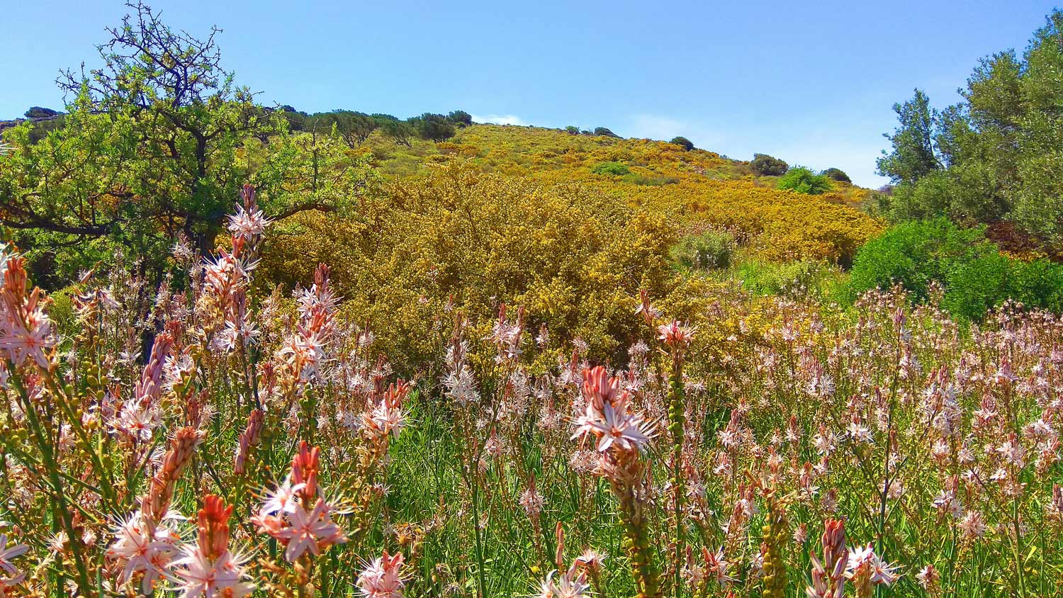
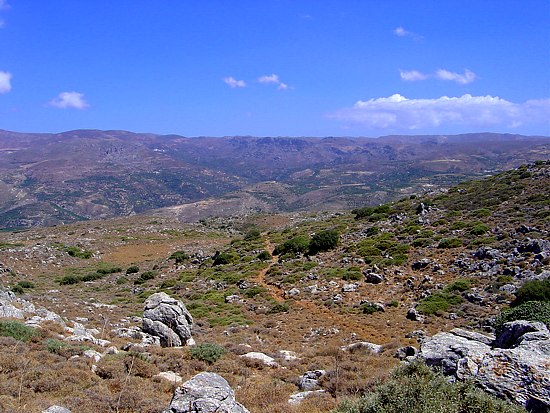
The low vegetation on this last part of the route is complemented by thymes, gorse, aspalathi (which make life difficult for those who came in shorts), but the show is stolen by the giant flowering thistles (onopordum) with their blue flowers, in which one finds that bugs you can imagine: insects, bees, beetles, snails, butterflies. They are so high that they reach up to our chests, we don’t even have to bend down to photograph them. There are ‘forests’ of these, the region favors them here, as it seems.
Additional Info
Altitude: Lowest point : 80m Gorge Exit – Highest point: 280m
Starting Point: See on the map above
Path Type: The first 1 km on a abandoned dirt road. After this point we enter the river bed. The way back on asphalt road, stone path and dirt road
Difficulty: Easy to Moderate
Walk distance (and back to starting point): 7 km : 3 hours
Adrianos Gorge in Lasithi: Crete’s Well-Kept Secret The Adrianos Gorge in Lasithi is one of…
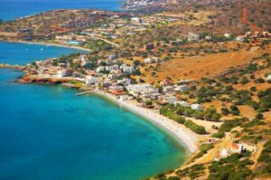
To reach Plaka coastal village you can take the coastal road north of Agios Nikolaos…
A world-famous tourist resort north of Agios Nikolaos, with lacy, windless sandy beaches, crystal clear…
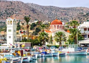
We leave our vehicle at the parking lot next to the Venetian windmills and near…
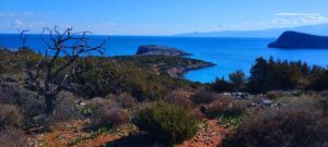
The island of Kolokytha or Vryonisi is located in the Gulf of Mirabello opposite the…
The lighthouse of Aforesmenos is located 27km north of Agios Nikolaos, 20km from Elounda, and…
From the village of Vrouchas we drive downhill on a narrow cement road at the…
A relatively small but impressive gorge with many changes in its landscape is the unknown…
16km west of Ierapetra is located the traditional village of Mythi or Mithi. In a…
This route which we recommend is one of the most exciting hikes in eastern Crete…
The point that you are to start trekking to the Katofigi cave, is about 200…
Just before the Lapathos plateau we head northeast on a dirt road and proceed uphill…
An unknown but beautiful route through the western mountains of Sitia and the wider area…
A beautiful route through the pine forest of Psichro, Agios Ioannis about 20 km east…
About 1,5 km to east of the village of Zakros, starts the Gorge, which ends at…
One of the most spectacular hikes of eastern Crete is the route of extremely beauty…
Related Articles
This Post Has 0 Comments