
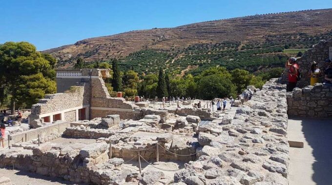
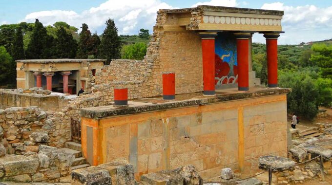
Expanding on the initial overview, the archaeological site of Knossos is a complex palatial city…
Pachia Ammos Beach and Village
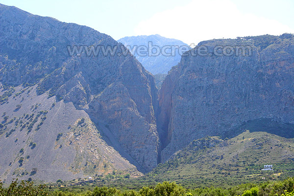
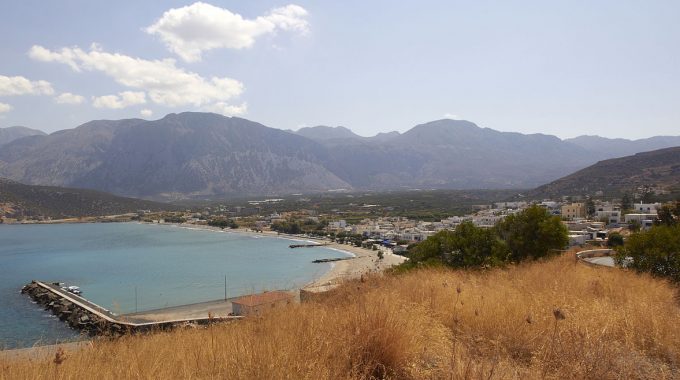
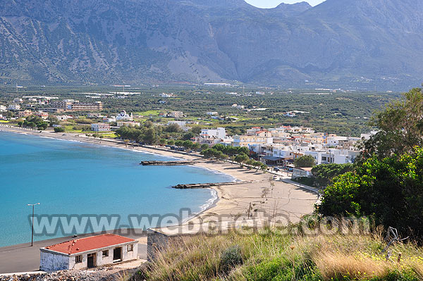
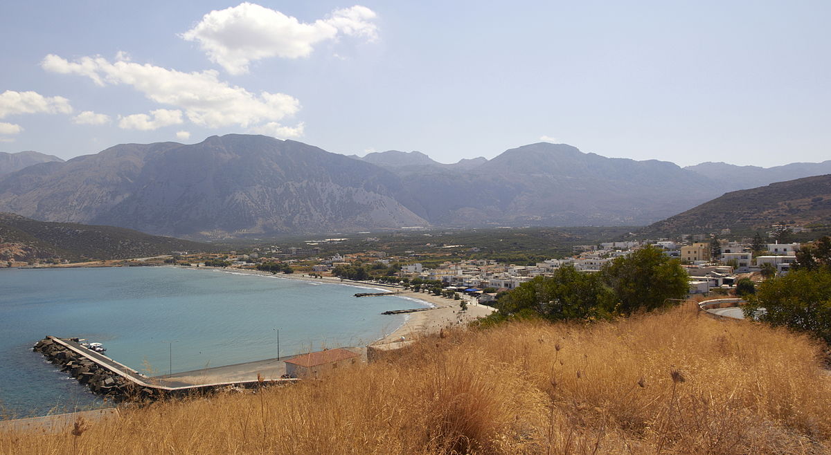
Pachia Ammos is situated in the northern part of the county of Ierapetra. It covers the area from the western slope of the mountain “Thripti” to the coast at the creek of the gulf of Mirabello. Pachia Ammos is situated on the most southerly point of the Bay of Mirobello. It is 1 hour drive from the Airport of Heraklion. Pachia Ammos is 20 minutes drive from Agios Nikolaos and 10 mins drive from Ierapetra on the South coast. East of the village of Pachia Ammos stands the imposing Ha canyon which is refuge of many species of Cretan flora and fauna.
The municipality of Pachia Ammos conisits of the villages:
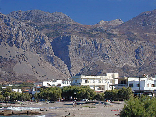
Pachia Ammos, a coastal village of 495 inhabitants, 15 km north of Ierapetra and 21km from Agios Nikolaos, is the seat of the municipality. The village has a small harbor and a long sandy beach.
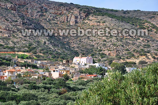
Vasiliki, a traditional village located on the hill overlooking the area at 90m a.s.l. 5km away from Pachia Ammos, with 191 inhabitants.
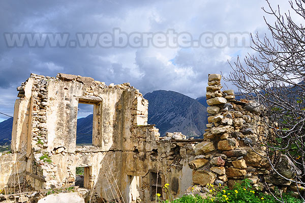
Monastiraki, a small traditional village of 20 inhabitants built on the foot of Thripti mountain close to the gorge of Ha. It is located 5 km southeast.
Visitors would be advised to hire a car for convenience although a taxi service is readily available. There is a very good public bus service which is always on time and travels the whole island daily. Pachia Ammos is a stop on this service, cars can be hired at Agios Nikolaos-Ierapetra and Istron, there are many different companies to choose from.
Additional Info
Location: Ierapetra Region – 15 km far from Ierapetra – 20 km from Agios Nikolaos
Access: Asphalt road
Residents: 488 (2017)
Αltitude: 10m
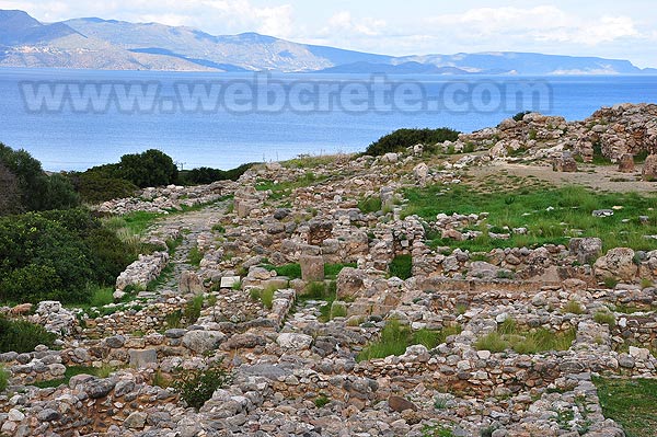
Gournia archaeological site
Gournia is located on the old road between Agios Nikolaos and Ierapetra, about 1 + 1/2 hours from Heraklion, and…
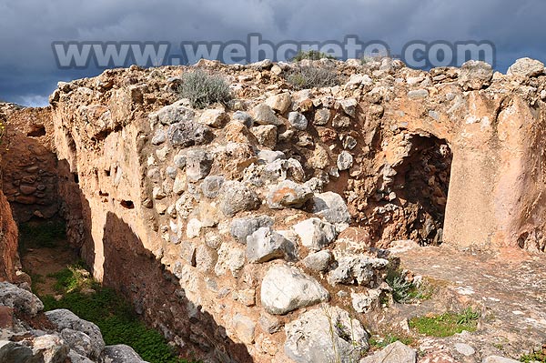
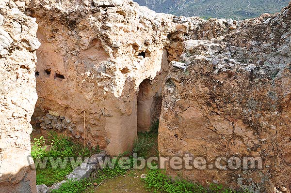
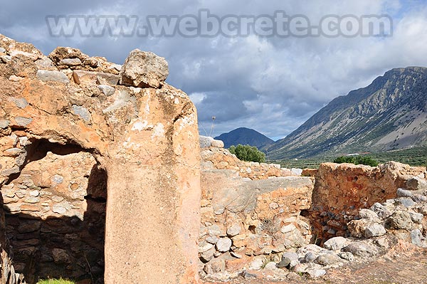
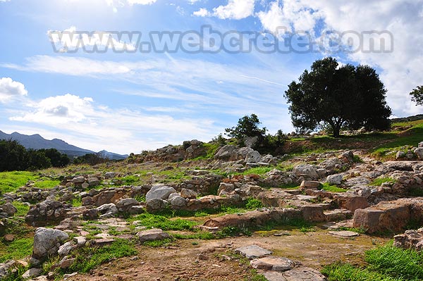
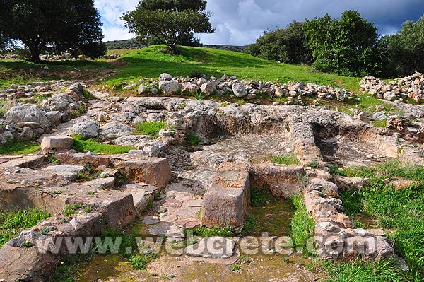
The settlement of Vasiliki is one of the first Minoan settlements with town-planning. It occupies the top and slopes of a low hill near the village Vasiliki, in the vicinity of the Minoan settlement of Gournia. The first settlement dates back to the Early Minoan II period (2600-2300 B.C.) and owed its development not only to the strategic position, controlling the Isthmus of Hierapetra, but also to the neighbouring fertile plains. The central building of the settlement was destroyed by fire in around 2300 B.C. The hill was again occupied in the Middle Minoan period as attested by a building of the period (2200-1900 B.C.), while scant traces of habitation date to the Roman period.
The most important monuments of the site are:
The “House on the Hilltop”. A large building, which can be considered a forerunner (on a small scale, however) of the later Minoan palaces. Its orientation, with the corners pointing to the cordial points is possibly influenced by Oriental architecture. The rooms are rectangular, connected with long corridors. The south wing is the largest. Some of the oblong rooms can be considered magazines, others are personal quarters; the building includes a paved courtyard with a rock-cut well or light-well. The interior surface of the walls was covered with red plaster, while the walls were reinforced with timber frame. The walls of the ground floor are built of small stones, bounded with clay and straw, while those of the upper storey were made of mud bricks.
House A. It is a typical example of the Middle Minoan “agglutinative” architecture, with rooms added when needed; the plan of the houses, however, had a certain regularity. It is located at the junction of two streets and has a narrow doorway entered from the stepped street. It seems that the settlement had four main building phases, each represented by remains of houses . Especially in the Middle Minoan period, the houses must have extended to the whole of the east side of the hill.
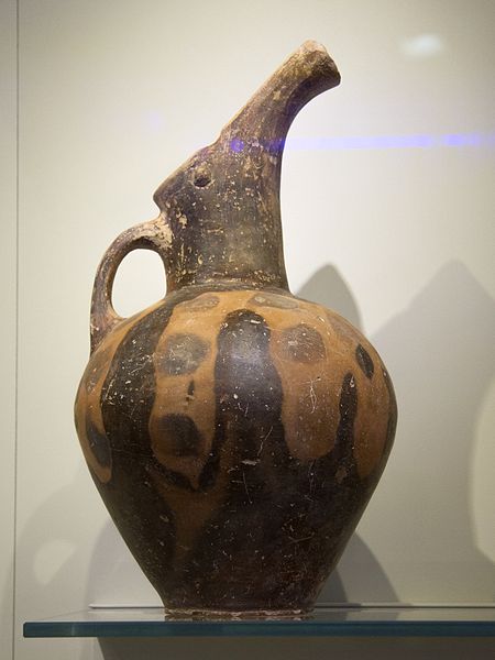
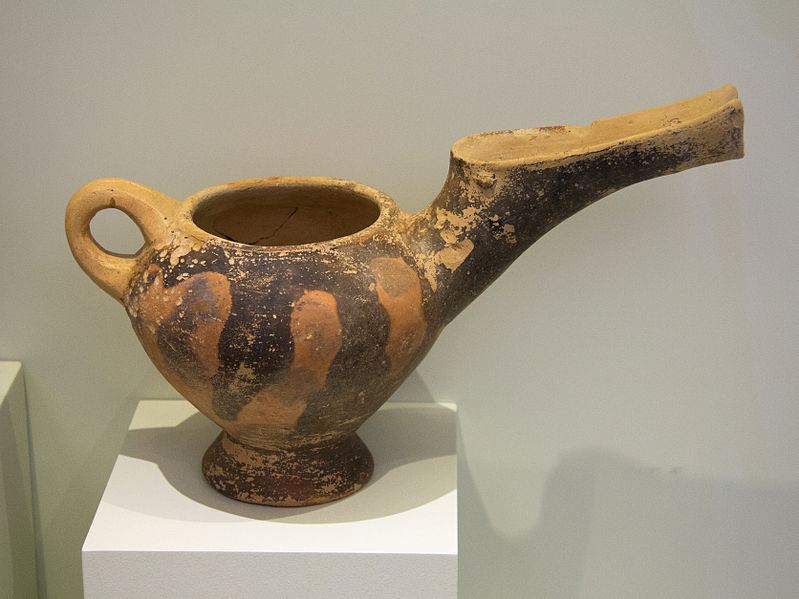
Vasiliki Style jug (Date: Early Bronze Age, 2500-2200 BC)
This characteristic beak-spouted jug of the Prepalatial period comes from Vasiliki near Ierapetra, one of the most important Cretan settlements of the Early Bronze Age. The local pottery style of Vasiliki combines daring tall-necked shapes with a stained decoration obtained by uneven firing of the clay. This jug is made of a light coloured clay and has a large spout resembling a bird’s beak. Two plastic disks placed on either side of the handle at the base of the spout recall the bird’s eyes, while the overall shape of the body conveys the lively figure of a bird looking upwards. The red flame-like stains on the brown surface were obtained by sticking leaves onto the clay to prevent it from firing evenly.
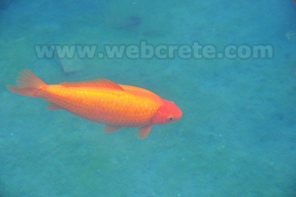
At the most narrow point in Crete, between Ierapetra and Agios Nikolaos, there is Vasiliki, 5km south from Pachia Ammos, the village with the renowned coffeehouses and the small square with a lake full of goldfish.
After systematic and time consuming excavations important archaeological findings that had been crucial to the specification of the early Minoan technology have been discovered in the village. In fact, some earthen pots were so special that their style was named after the village since something similar to them had been found nowhere.
Sights:
At Venetsanos location there are ruins of a paleochristian temple (4th- 6th century) that is thought to have been built at the foundations of a previous idolatry temple.
INSTAP Study Center for East Crete is a unique facility for archaeological research, especially in the area of Aegean Prehistory. The Center is committed to stimulating and facilitating publication in the broader field of Cretan studies, with a focus on archaeology and ethnology.
The Center provides storage space for artifacts from American and Greek-American excavations in eastern Crete and offers services for the primary study of excavated material to both member projects and individual scholars. On a broader level, the Center also functions as a base of operations for individuals engaged in a wide range of Cretan research topics unrelated to the member projects. The numerous facilities and services at the Center are available to both individuals and projects.
For information about availability, contact Thomas M. Brogan, Director of the INSTAP Study Center for East Crete.
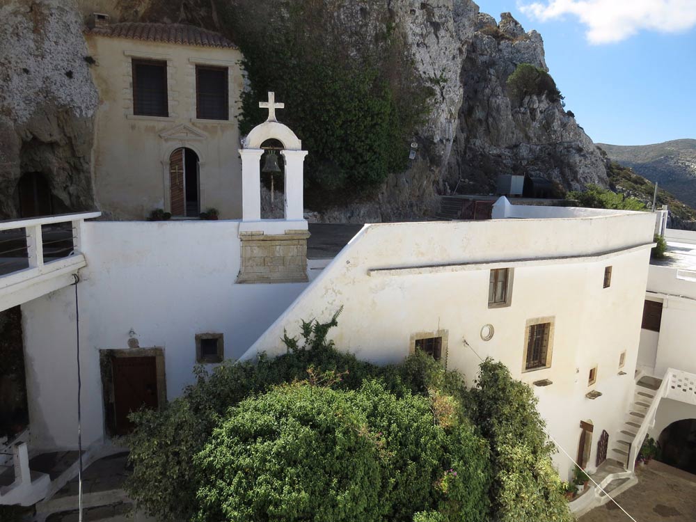
Faneromenis Monastery, Ierapetra
One of Crete’s most historic monasteries, Faneromeni (Our Lady Revealed) Monastery is situated on a slope overlooking the Minoan city…
We bypass the Monastery of Vriomeni on its northern side. Having passed a small stone building on our right, we follow the dirt road north-east, climbing up a bare slope. We continue for approximately 600 m; we ignore a left-hand side road (1) and immediately after pass through the southern side of a small plateau with vineyards, 500 m east of which there is a left-hand turn-off (2) that we ignore. We continue straight on, in a southerly direction.
We then bypass a low peak on its southern side and follow the main dirt road which meanders on the slope. Cultivated terraces, almond trees and scattered farmhouses can be seen on our left, at a location called Langada (3).
We ignore any turn-offs that we come to and head towards the eastern side of a small flat area with vineyards, located on the lowest part of the slope. At the foot of the slope there is a drinking fountain.
From the Monastery of Panagia Vriomeni to this flat area and the small agricultural settlement of Langada the distance is approximately 2 km in total.
We leave the flat area and continue straight towards the east, along the slope, having to the south a view of the area surrounding Ierapetra.
After 1.100 m of walk, we ignore a right-hand downhill side road (4) and after another 1.300 m, we follow a left turn-off (5); we then descend towards the small valley of Assari, where a chapel can be seen. There are also an old stone drinking fountain and the ruins of buildings that used to be part of the old Dependency of the Faneromeni Monastery (6).
Once we are in the valley, we follow a dirt road to the right, initially in a southerly and then an easterly direction, parallel to a small water course.
Still following an easterly direction, wel eave the valley behind and pass by a small plateau with a few olive trees here and there.
We continue straight on and reach the northern side of a bare hill, having a dry water course down below to our left.
Reaching the flat hill top (2,5 km from Assari), the distant view of the gorge of Ha opens up eastwards ahead of us, as well as of the Cretan Sea, northwards.
We ignore a northern turn-off (7) and continue on the main unsurfaced road, initially southwards and then north-eastwards, heading to Vasiliki (8).
Related Articles
This Post Has 0 Comments