Adrianos Gorge in Lasithi: Crete’s Well-Kept Secret The Adrianos Gorge in Lasithi is one of…
Zonari – Neraidogoula Cave
It is another unknown but beautiful route in the forest of Selakano. This time we will cross a large section in the southern part of the forested valley of Selakano.
The access to the starting point of the hike is via a dirt road from Metaxochori and a vehicle that can cope with a dirt road of moderate condition is required. There is also access by a dirt road, from the south, from the village of Riza and further through the settlement of Karydi, but the last 1.5 km is in bad condition.
We leave the vehicle at the starting point (see the map below) which is on the Zonari stream, which stream a little further down forms a canyon that can only be crossed by someone with technical equipment. The Zonari stream ends up joining the Myrtos river which passes through the beautiful Sarakina gorge.
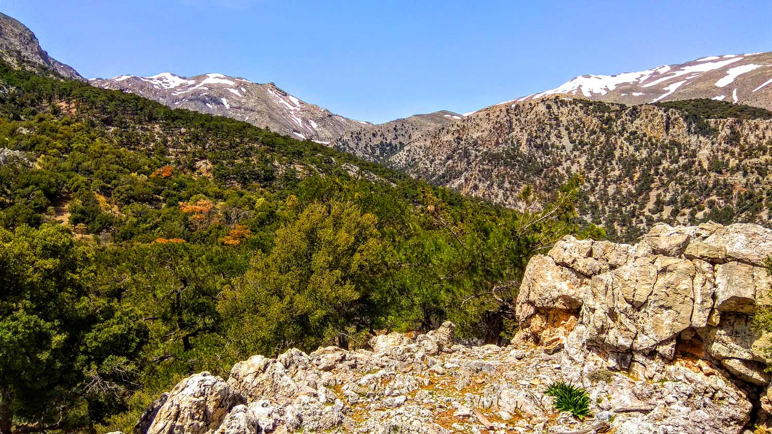
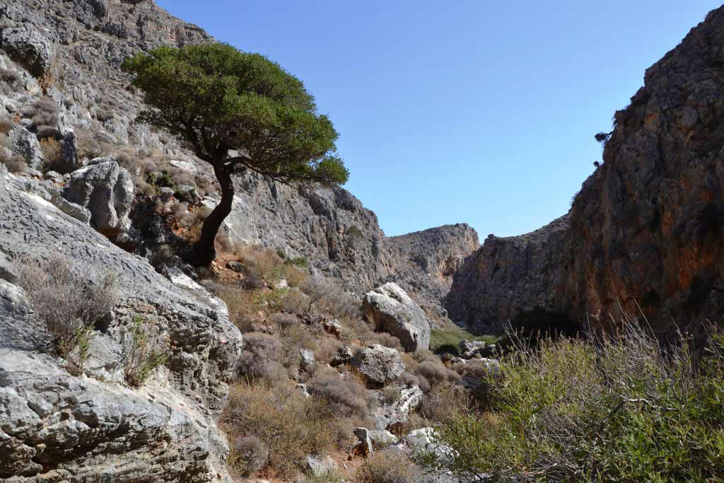
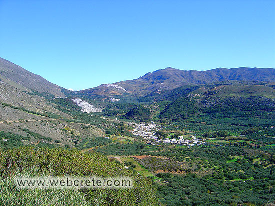
From this point and already at an altitude of 750m we start and walk on a dirt road (which is not recorded on Google maps) that heads northwest, through the Zonari stream. The forest presents us with amazing sights and smells as we climb into a beautiful environment with pines and privets scattered along the stream bed.
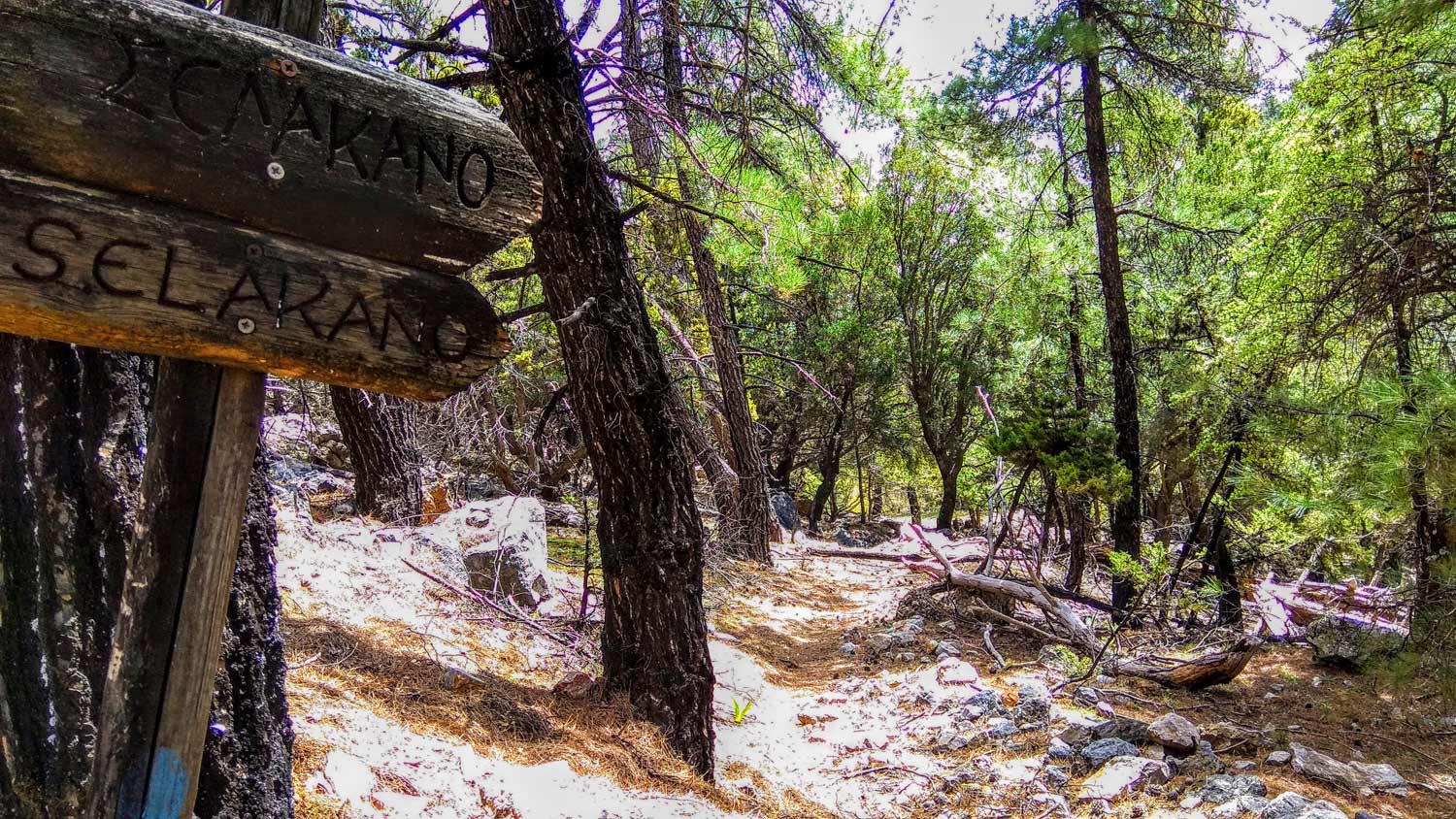
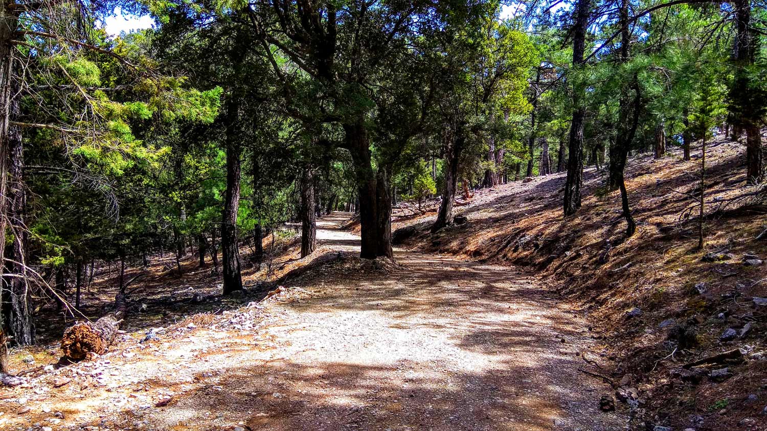
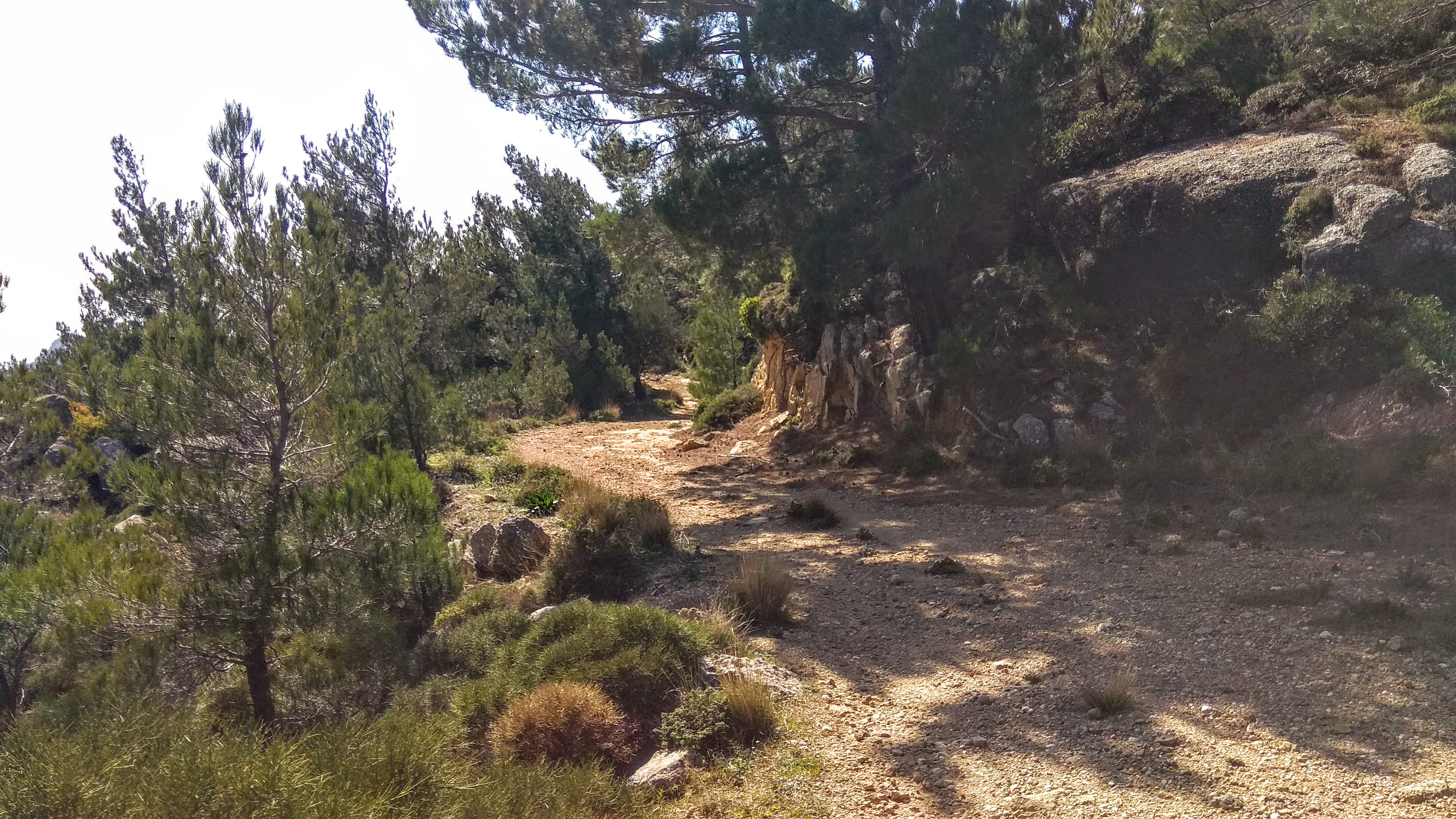
The route on the dirt road is about 4km long until its end, and at 1050m altitude, a well-formed and distinct path begins along its entire length, which leads us deeper into the heart of the forest.
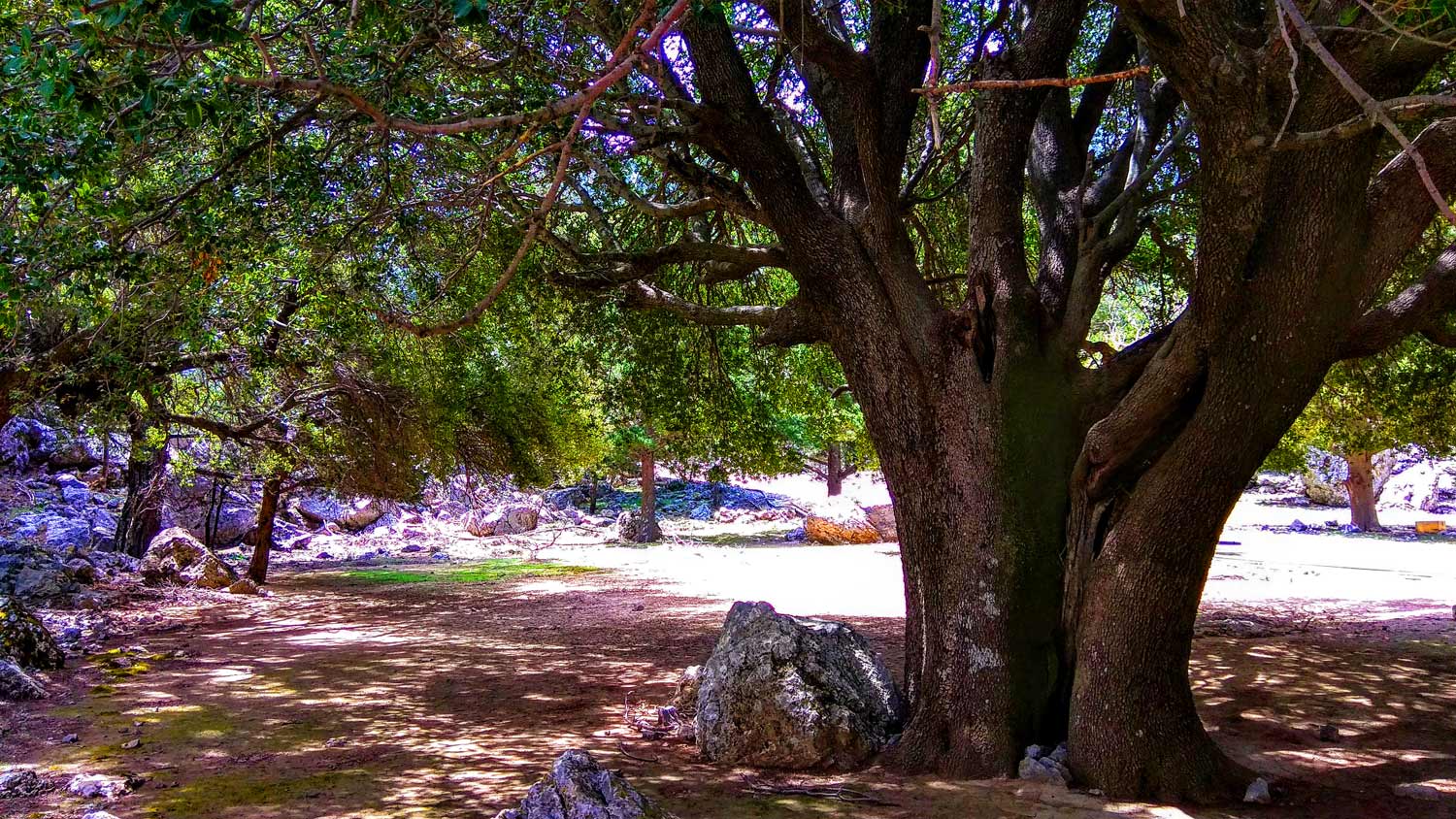
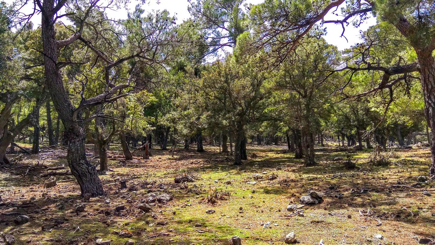
This is the most impressive part of the route because we are moving completely under huge pine trees. The species of the tree is “spine pine”, which is found mainly on the leeward southern slopes of the great mountain ranges of Crete, where it is protected from the moisture of the northern winds. If you look in some places, on the north side of the trees, moss has grown, and this is where the best honey comes out, due to the fermentations, from the bite of a bacterium on the trunk of the tree.
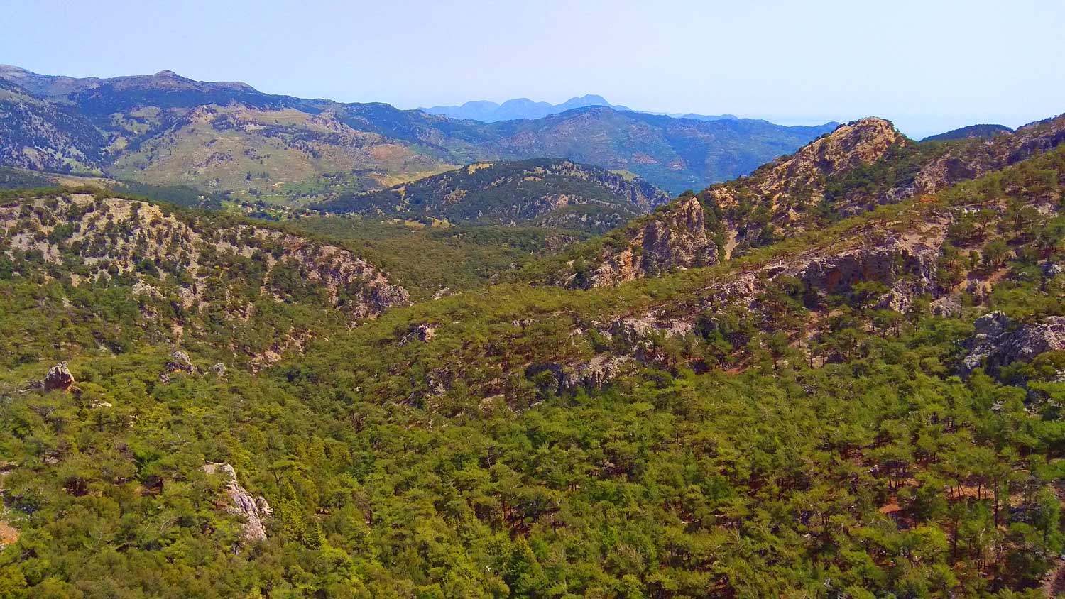
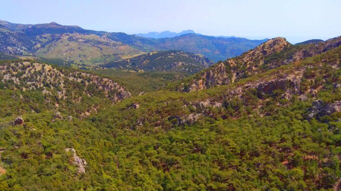
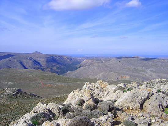
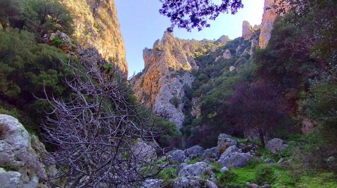
In a little while we reach the highest point (1227m) of the route where we are at the intersection of 3 paths. The path with an eastern direction brings us after 150m to a place where the landscape forms a beautiful natural balcony at “Spyridou to Haraki” with an impressive view of the entire forest. The 2nd path descends in a direction initially north and then northeast and goes to Selakano settlement. The 3rd path heads south, goes for a while parallel to the stream of Linaras and in a short time we arrive in its bed where the Neraidogoulas cave is located at an altitude of 1221m.
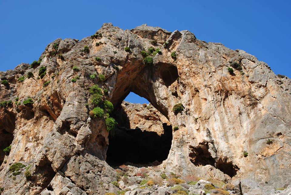
The cave of Neraidogoula
Neraidogoula is a special cave that in the past, as the locals remember, during periods of heavy rainfall, impressive amounts of water washed out from the small hole of its entrance even in the summer season, after the melting of the snow on the highest peaks of the mountains.
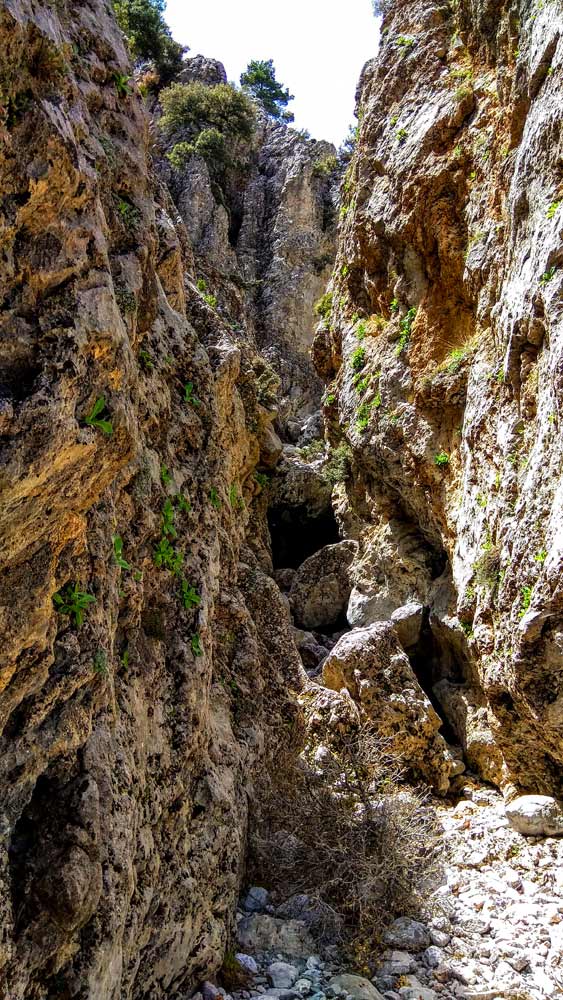
The cave is located five hundred meters south of the “Stou Spyridou to Haraki” location, near the source of Psychros, at an altitude of 1,227 m, in the bed of a ravine that creates the stream of Linaras on the north-eastern side of Psari Madara (south part of Lassithi Mountain range), and is considered to be an underground river.
Locating its entrance is a bit difficult, even though there are signs, mainly because it is very small and does not suggest the existence of a large cave inside. To enter Neraidogoula today, after finding its narrow entrance, one must crawl for a few meters and pass the first small room and through the second slightly larger hole enter the main cave, in a impressive hall of large dimensions. In the background is a small lake fed by the waters of the subterranean river, which runs constantly, which is evidenced by the constant deafening rumble of the movement of the water.
Stalactites
On the ceiling of the cave are stalactites (the larger ones are broken), the floor is covered with a large layer of dried mud, which has been carried by the huge quantities of water that pass through when the underground river floods. The place really awes you.
Additional Info
Altitude: Lowest point : 740m (Zonari stream-dirt road) – Highest point: 1271m Psichrou Spring
Starting Point: Dirt road at Zonari stream (between Metaxochori and Karydi villages)
Path Type: At the beginning (4km) parts of dirt road – After on mountain path – marks on trees
Difficulty: Moderate
Walk distance: 8,2 km : 2,5 – 3 hours
Sitia Geopark
The Natural Park of Sitia is on the easternmost edge of Crete, in the Municipality of Sitia. It covers the…
Traostalos is one of the highest mountains near the coast of east Crete and is…
We start from Elounda village by car and head west towards the village of Pines.…
We leave our vehicle at the parking lot next to the Venetian windmills and near…
The Chochlakies or Karoumes Gorge lies in the far east of the island, 8 kms…
A beautiful route through the pine forest of Psichro, Agios Ioannis about 20 km east…
At the coastal region south of Palm Beach Vai, the nature hides some treasures almost…
Kritsa is one of the oldest and most picturesque villages in Crete, Greece, built amphitheatrically…
The route Chrisopigi –Bebonas– Kavousi is easy to pass and we walk on a dirt…
Related Articles
This Post Has 0 Comments