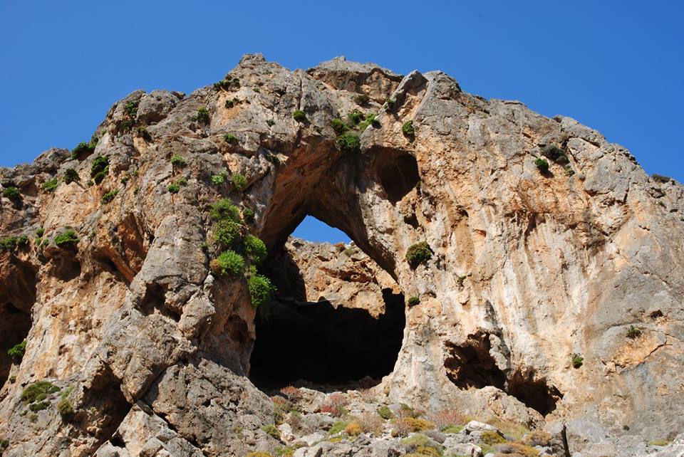
Adrianos Gorge in Lasithi: Crete’s Well-Kept Secret The Adrianos Gorge in Lasithi is one of…
From Omalos Plateau to Afendis (2142m)
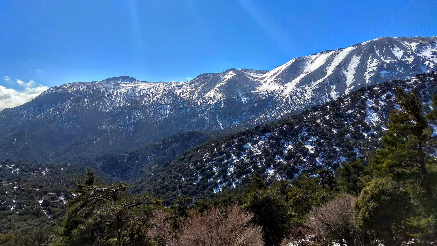
Today the ascent was made from the Omalos Plateau of Viannos which is at an altitude of 1,350 meters. It is quite a demanding hike, especially in the first part, not only because of the steep slope of the ground and the large height difference (about 800m), but also because of the microclimate of the area (hot during the day – freezing and strong winds at night during the studies).
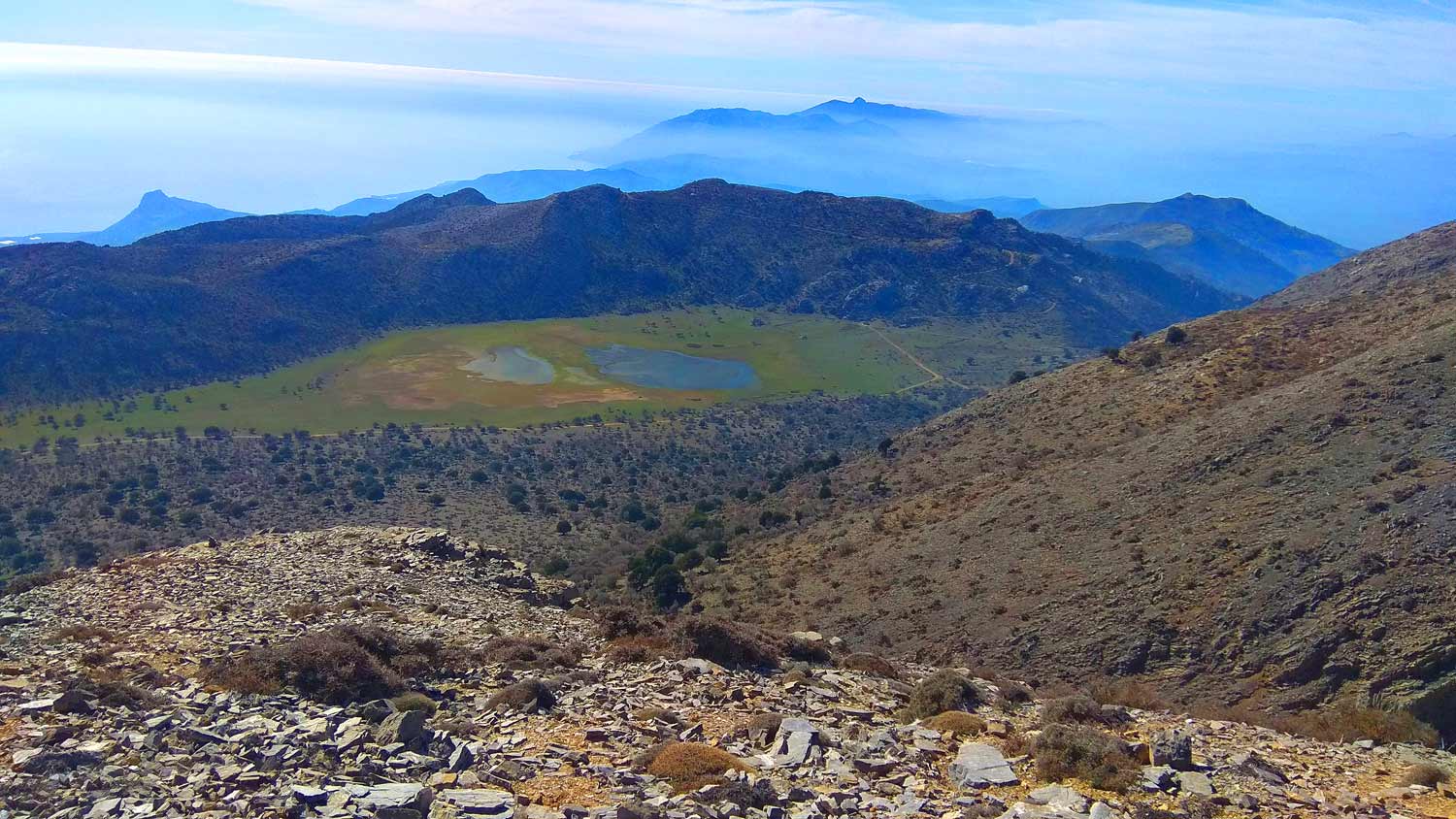
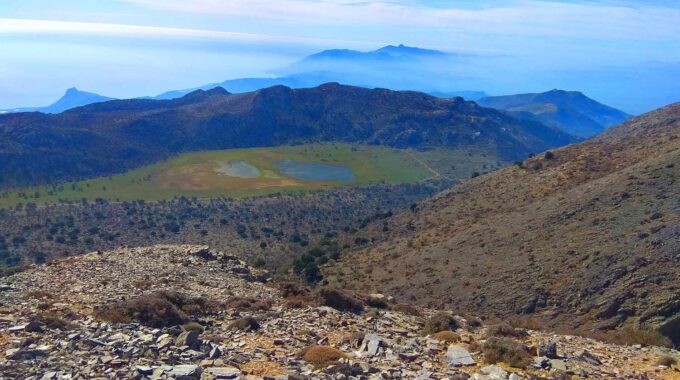
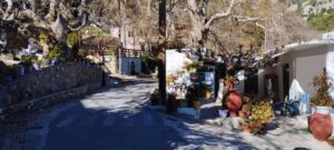
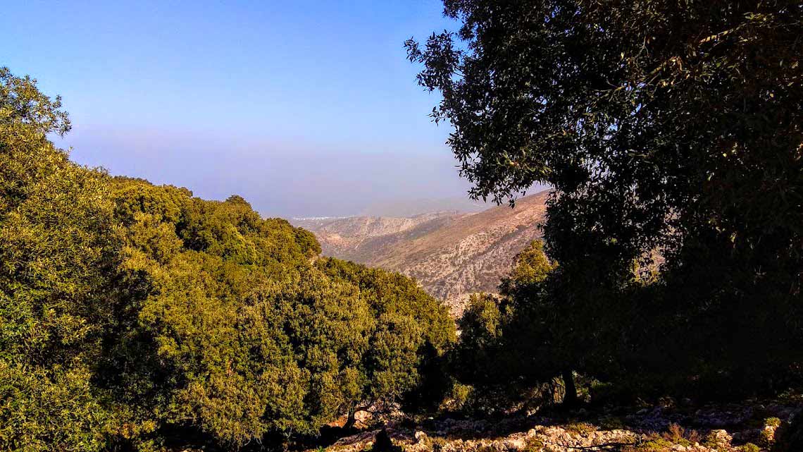
The arrival at the village of Kato Symi in the area of Viannos, is easy either from the east (31km from Ierapetra) or from the west. It is a picturesque village with a chilling, bloody history from the period of German occupation. From here we continue for 5 km on asphalt initially and another 5.5 km on a dirt road to the picturesque plateau of Mikros Omalos, an uninhabited, untouched, deserted plateau. ‘Small’ only in name (to distinguish it from the homonymous Omalos plateau in Chania), but beautiful as it changes a thousand faces depending on the seasons and weather conditions. Sometimes green or snow-covered, with a small alpine lake created when the snow melts on the surrounding mountain peaks. The famous hero of Ioannis Kondylakis, the delightful Patouchas, in his novel of the same name, grazed his animals on this plateau.
We left our vehicle shortly after the pass on the picturesque plateau and immediately began the climb to the top.
At the beginning for about 1 km we moved west-northwest until we met the path which now heads north.
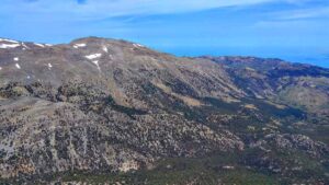
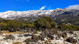
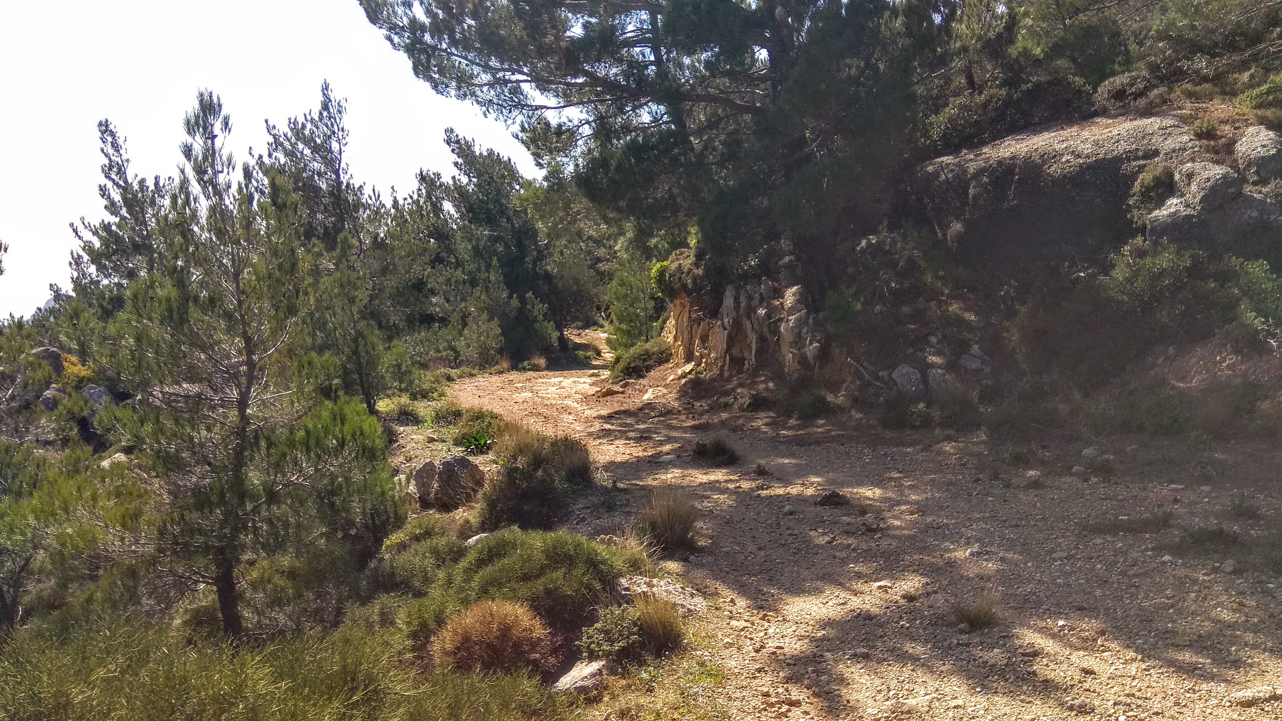
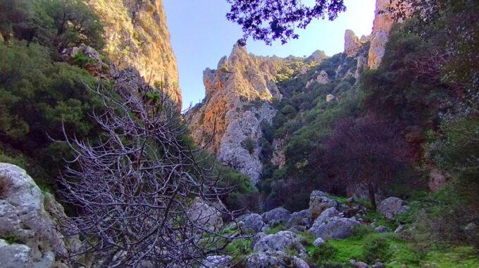
The course is steeply uphill, the path at that point is indistinct and needs attention as it is paved with small and large stones that make walking difficult. The most difficult point can be determined from 1400m where the sharp slope begins until 1900m where the route becomes more flat. Initially there is sparse bushy vegetation and impressive privets that managed to survive and grow tall despite the adverse weather conditions. As we climb, the vegetation thins out and the stones seem to become more numerous after each step we take…
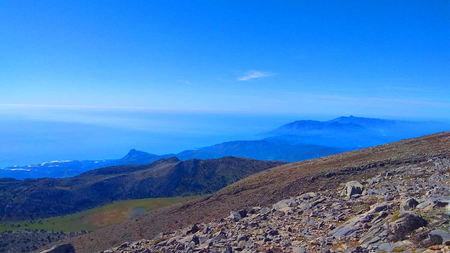
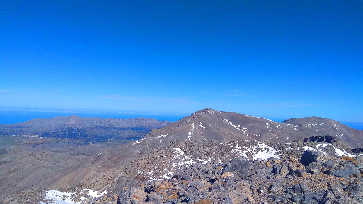
From above we gaze at the plateau of Mikros Omalos, perched between the Lasithi mountains, in one of the most beautiful mountain landscapes of Crete. We continue the difficult climb (the feet of those who are not used to walking in the mountains will definitely suffer) and from a distance, like another rock on the top, the small chapel emerges. The landscape around us is treeless, wild and inhospitable, as after 1,600m. there is no vegetation at all, but low bushes, innumerable stones, and gray sharp rocks.
The most spectacular part:
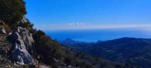
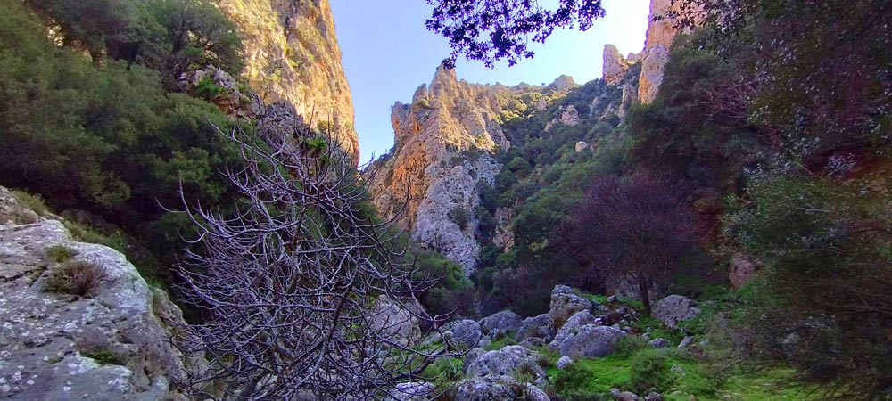
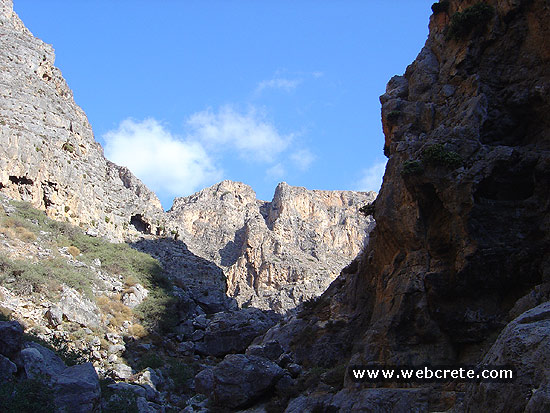
The most spectacular part of the route can be found approximately 30-40 minutes before the summit and at 2050m. where the path leads us to the edge of a huge rock and cliff with a commanding view of the valley (over 1000m altitude difference!) west of the massif where we are.
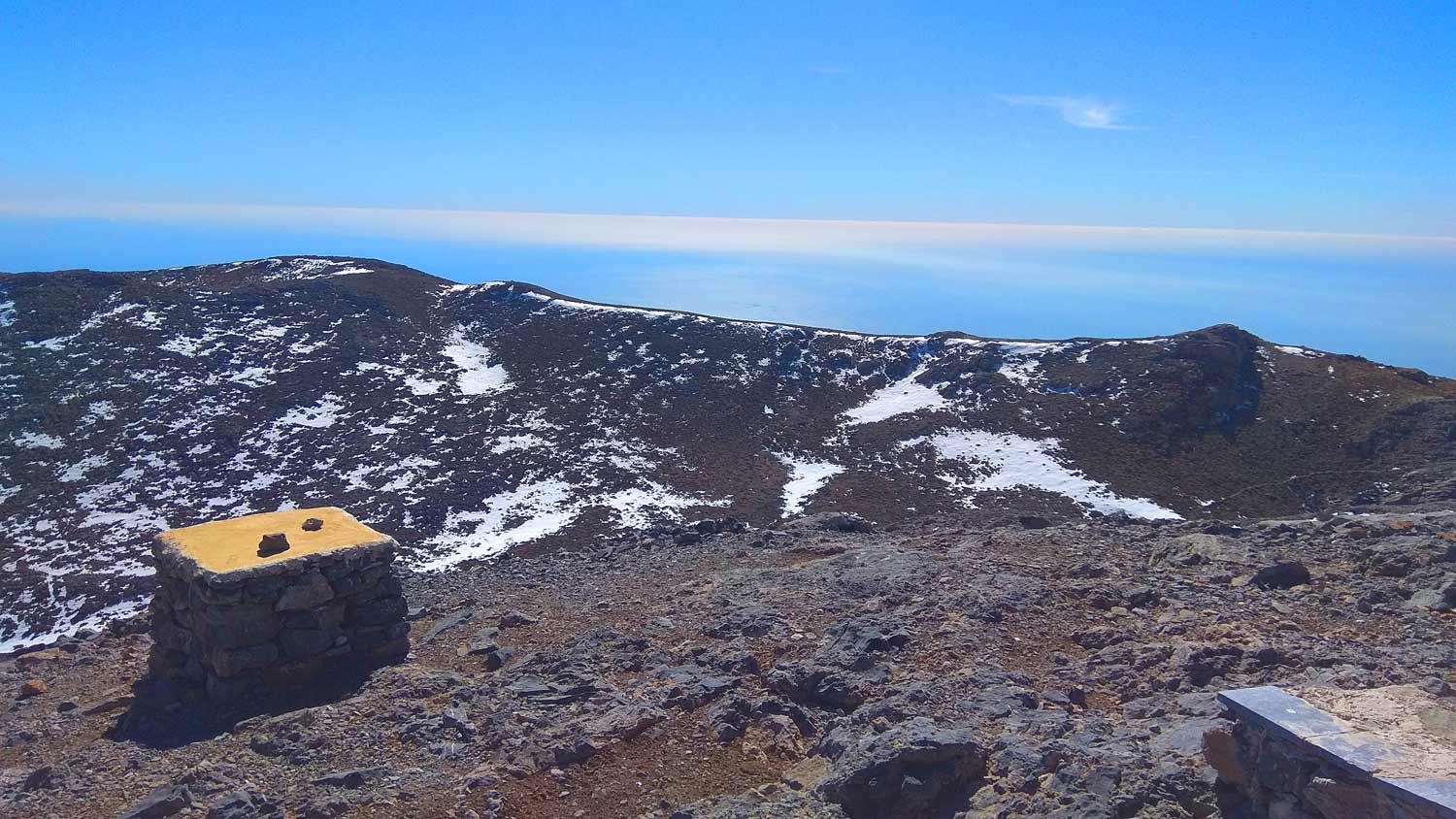
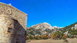
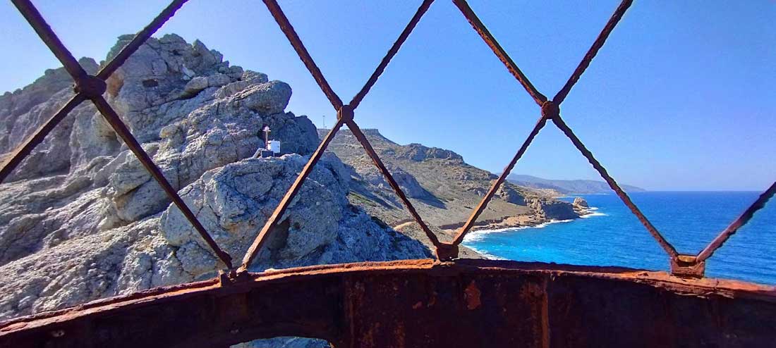
After 3 hours of strenuous climbing we finally reach the top. Pilgrims from the province of Viannos, the city of Heraklion, the plateau and the prefecture of Lasithi flock to the small chapel every year for the celebration. Many spend the night staying in tents and others start early in the morning to arrive before the service. The redundant little church looks like it is part of the mountain itself, as it is built with the same stones that abound around and a large part of it is embedded in the mountain. At this point there was a cave, which, according to the mythological tradition, was the residence of the leader of the Sarandapechi.
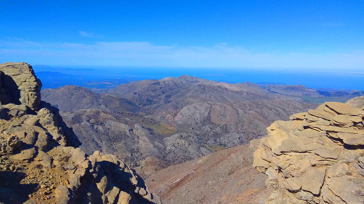
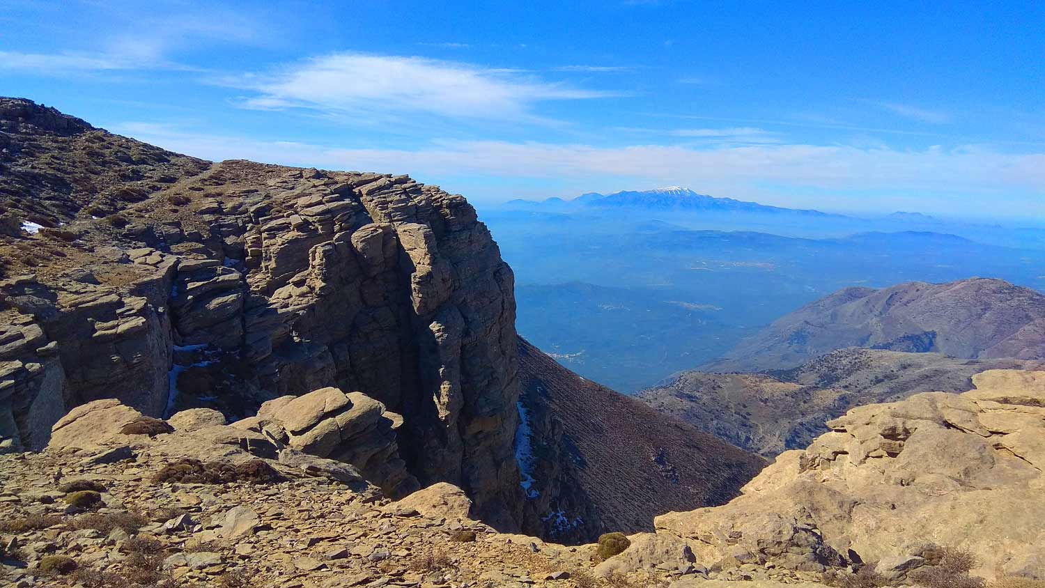
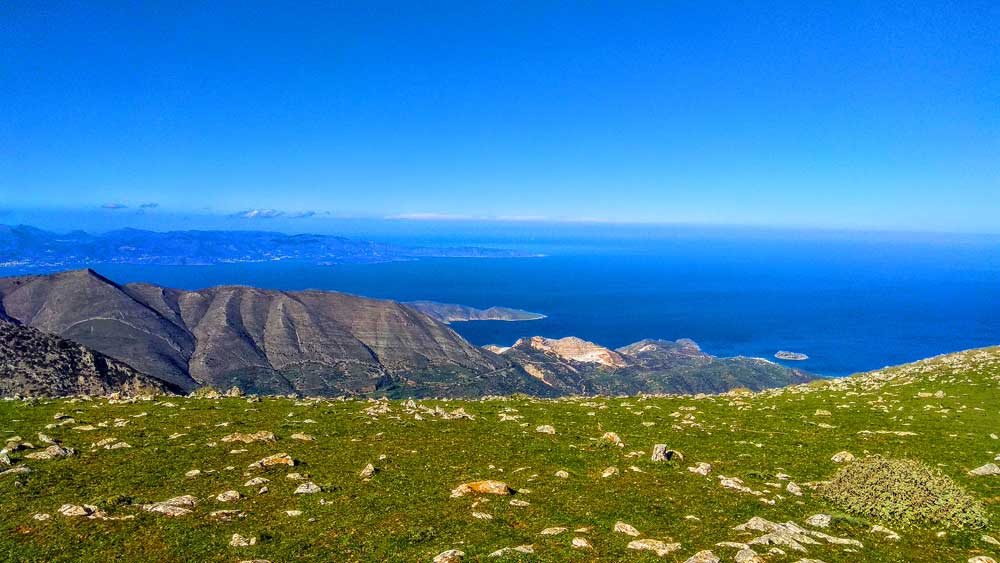
We rested at the top with the wind blowing strongly and enjoyed the panoramic view of the entire island: from Heraklion, Messara plain and Hersonissos, to the Lasithi plateau, Agios Nikolaos and Ierapetra and from the White Mountains and Psiloritis to the two seas south and north of the island. The Diktis mountain range surrounds us unyielding and proud, with its high peaks and inaccessible mountain slopes involuntarily awe-inspiring.
Additional Info
Altitude: Lowest point : 1350m Omalos Plateau-Vehicle parking place – Highest point: 2142m Afendis Christos Peak
Starting Point: Omalos Plateau
Path Type: The first 1 km on a abandoned dirt road. After this point the path is not very clear for 30min. The rest until the top the path is clear and easy to discern.
Difficulty: Moderate to Difficult
Walk distance (and back to starting point): 8 km : 3 hours and 15 min
Just before the Lapathos plateau we head northeast on a dirt road and proceed uphill…
Walking on one of the most beautiful paths of eastern Crete, through black pine forests.…

Eastern Crete has dozens of enchanting and unknown destinations that "capture" every visitor, making him…
Lapathos Plateau is 9 kilometers far to east from Symi or Simi village in Lassithi…
Today the ascent was made from the Omalos Plateau of Viannos which is at an…
An amazing route in the southern Lasithi mountains, moving at an altitude of 900-950m and…
Kato Symi (or Simi) is a village and seat of the homonymous community of the…
Sitia Geopark
The Natural Park of Sitia is on the easternmost edge of Crete, in the Municipality of Sitia. It covers the…
An easy and spectacular route through the forest of Selakanos. If we want to avoid…
Adrianos Gorge in Lasithi: Crete’s Well-Kept Secret The Adrianos Gorge in Lasithi is one of…
An easy but spectacular route on the eastern side of the plateau. Almost the entire…
A beautiful route through the pine forest of Psichro, Agios Ioannis about 20 km east…
A very beautiful gorge close to the well known monastery of Kapsa in South-eastern Crete…
The small plateau of Monokara is located on Mount Ornos, at an altitude of approximately…
From the village of Vrouchas we drive downhill on a narrow cement road at the…
The usual route to Atzilakodasos starts from the location of Hamoprina, about 4.5 km south…
Related Articles
This Post Has 0 Comments