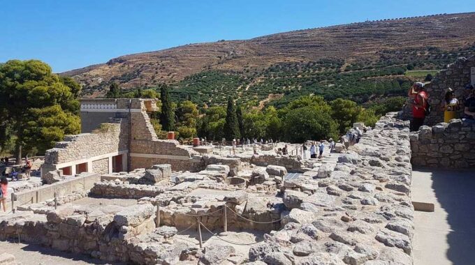
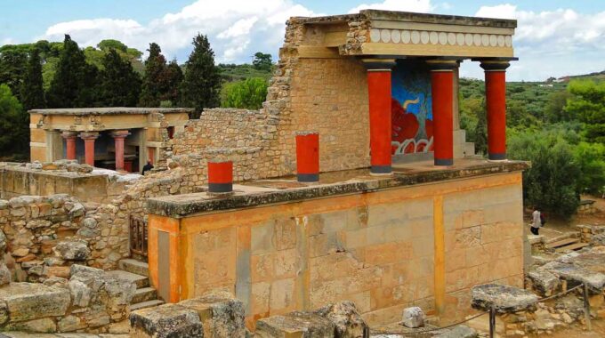
Expanding on the initial overview, the archaeological site of Knossos is a complex palatial city…
Omalos Plateau, Viannos
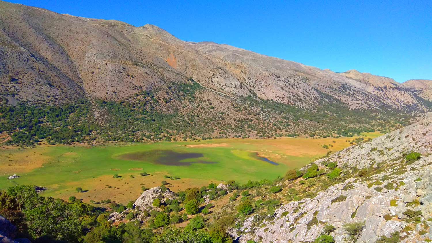
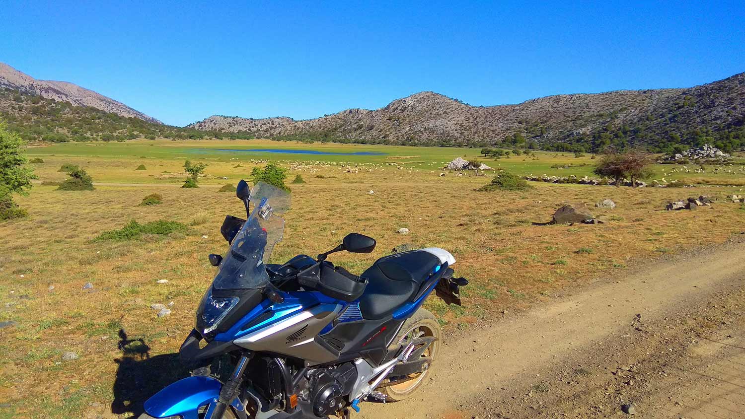
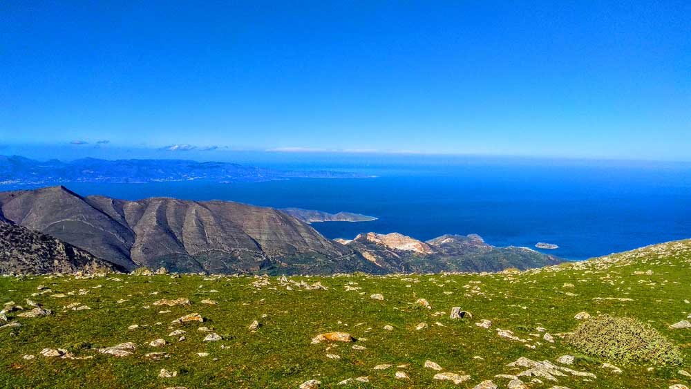
Eastern Crete has dozens of enchanting and unknown destinations that “capture” every visitor, making him want to come back again, one of them is the impressive lake of Omalos in Viannos, but also the entire wider area around the plateau.
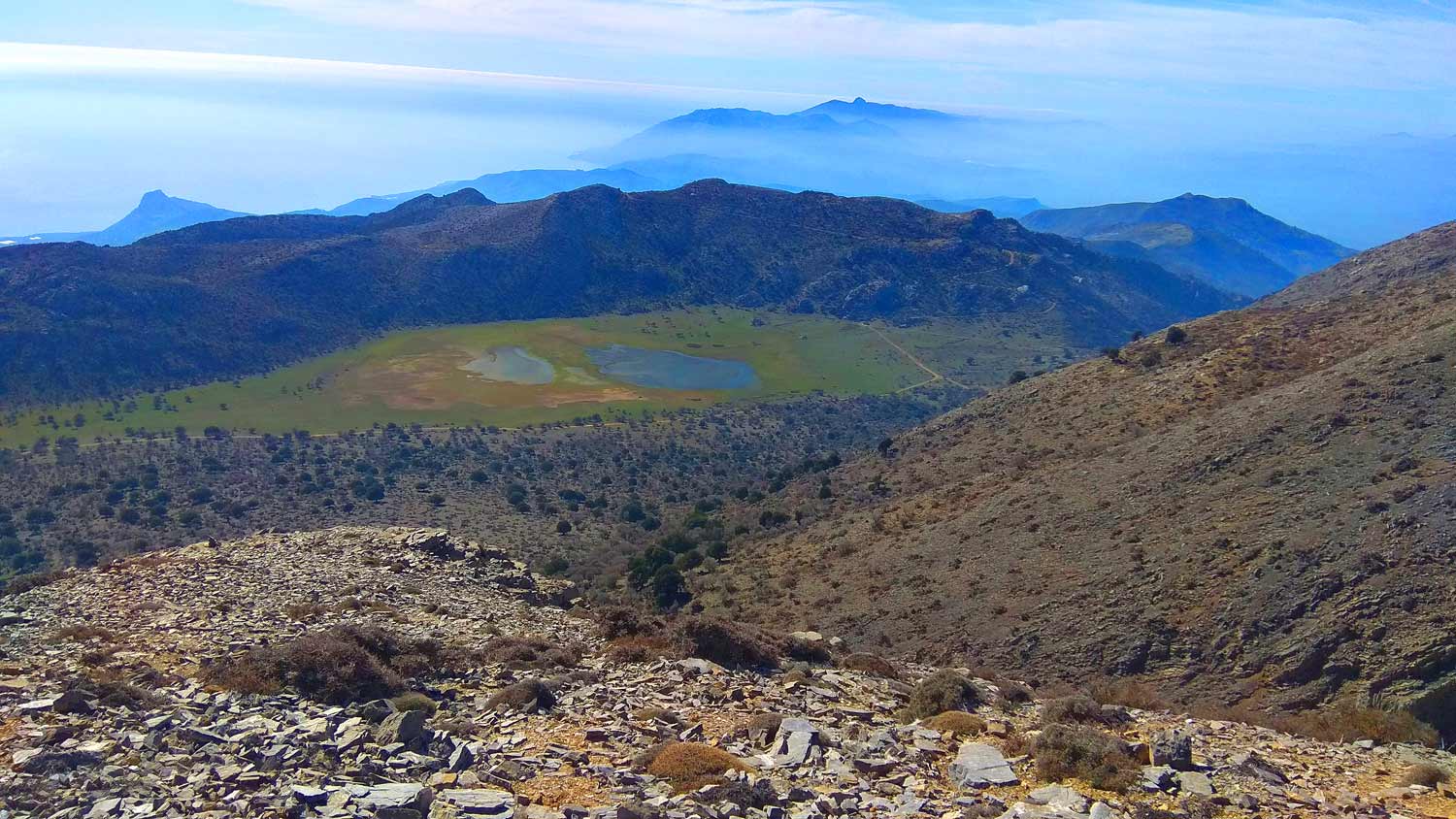
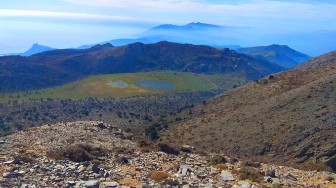
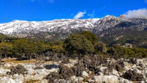
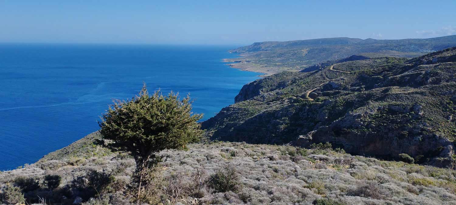
More specifically, the Omalos Viannos Plateau is located on the southern fringes of Mount Diktis, and south of the Afentis Christos peak (2142m), 60km southeast of the city of Heraklion.
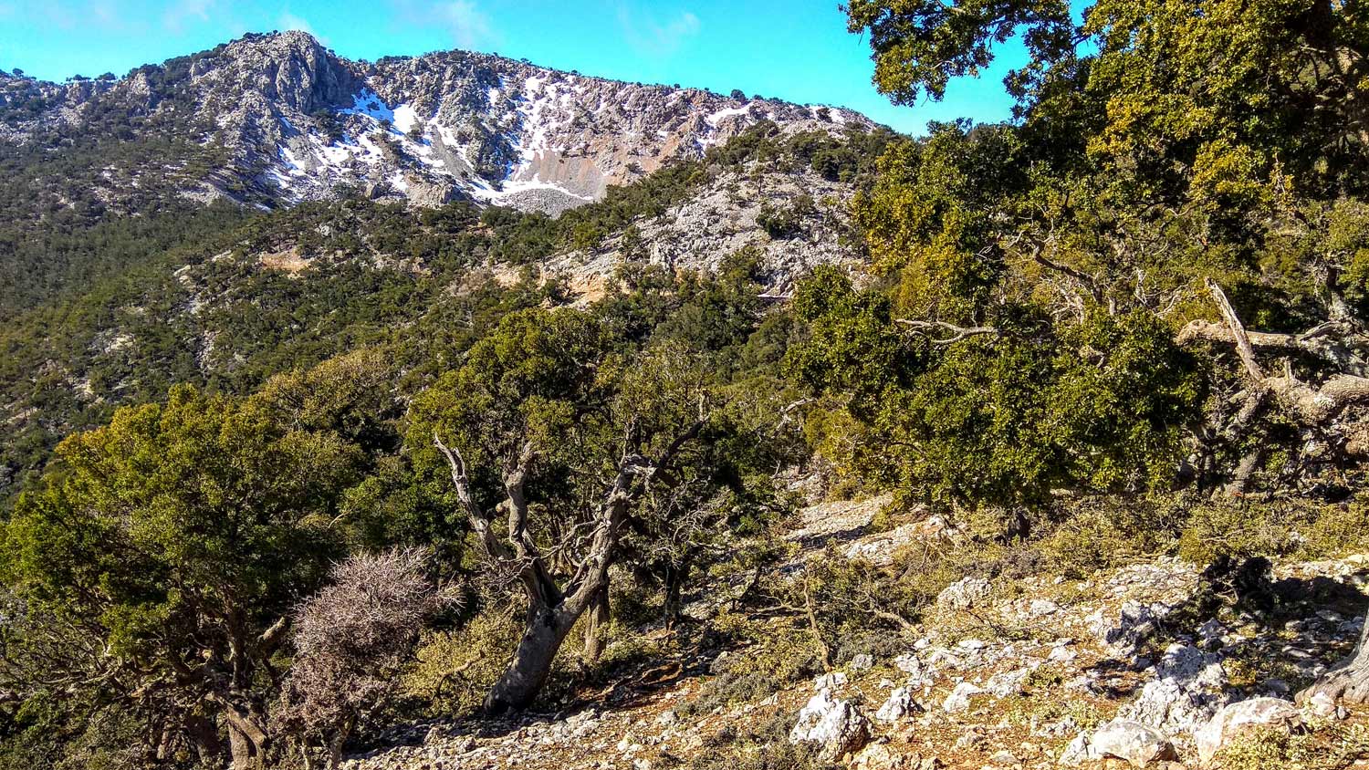
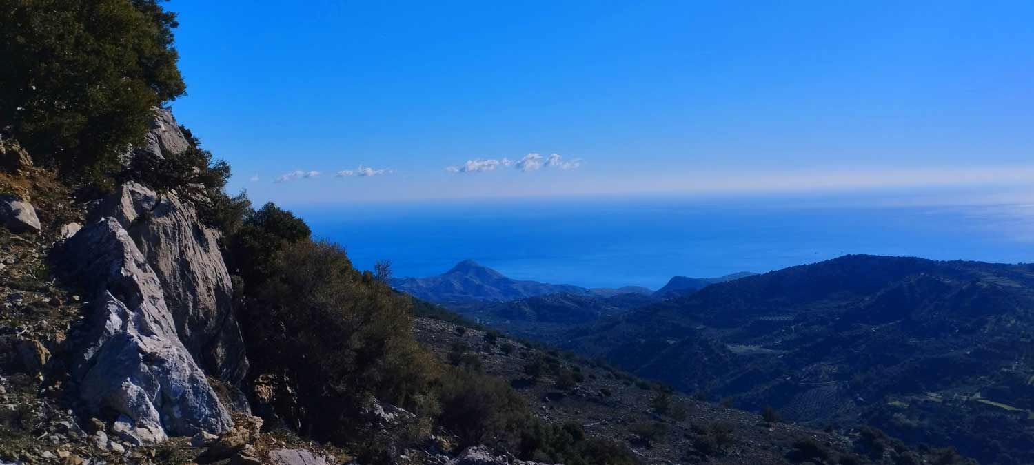
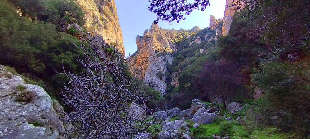
At 1200m above sea level, the dense pine forest that starts from Symi is succeeded by the sparse forest of privet (Quercus coccifera), a characteristic habitat of all the mountainous areas of Crete with a corresponding altitude. The grass and wildflowers of Crete, now freed from the dense layer of pine needles, soak up the light and air unhindered in the lower floor of the forest.
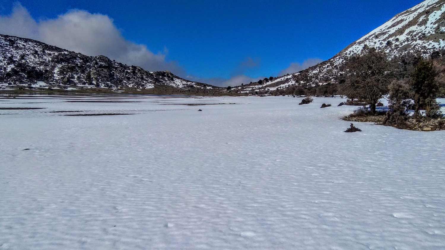
This plateau is only used by shepherds in the summer months, but it is the right place for a spring excursion and not only because even in the winter the mountain of the Master Christ is dressed in white and the landscape is reminiscent of… a dream. An incident that occurred once again in the winter of 2020 and “stole the eyes” of all of Greece.
So when these snows melt, the natural lake is created in the center of the plateau, which is maintained until the summer and its waters are drained through the ground, enriching the water table of the area.
Access to Omalos..
Access to Omalos Plateau, Viannos is relatively easy through the forest dirt road that starts from Kato Symi, but there are also other difficult or less easy dirt road routes that you can follow.
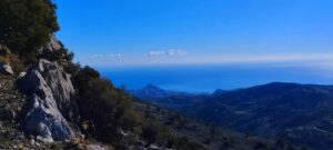
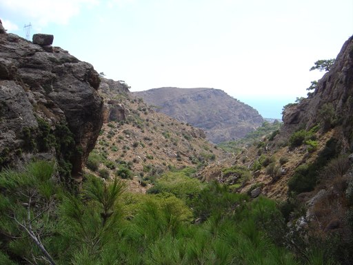
From the settlement of Amiras, where the distance is close to 9 kilometers, while there is also a dirt road that comes from Ano Viannos and joins another one from Kefalovrysi village and together continues to the plateau after passing below the peak of Pandouras (1513m ). This road is used a lot by the shepherds of the area and is generally in good condition apart from 1-2 spots that need some attention. It is the road with the highest mountain pass (at an altitude of 1500m) in the entire Lassithi massif.
Also, from the southwest side, there is the alternative route that goes up from the village of Miliaradon near Embaros and passes south and parallel to the wild gorge of Erganos. It is the most difficult of all with steep inclines and less frequent maintenance intervals.
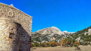
Of course, the great value of the route culminates with the approach of visitors and hikers to the central point of the Omalos plateau (average altitude 1,340 m). The plateau develops on the East-West axis, at the base of the southern side of the alpine central part (madares) of the Lasithi mountains, occupying a respectable surface. During most of the wet season the entire wider area is covered by snow, ice or water. The plateau has its own meandering network of channels, which, through a sinkhole, channels the winter water from the seasonal lake reservoirs to the underground invisible world. The portions of the plateau surface that become dehydrated as we head into spring quickly green up to be used as pasture soon after.
However, it is worth noting that many visitors and even residents of Crete confuse Omalos Plateau by Viannos with the famous plateau of Omalos in Chania, which is why it is customary to call it Little Omalos.
Just before the Lapathos plateau we head northeast on a dirt road and proceed uphill…
Walking on one of the most beautiful paths of eastern Crete, through black pine forests.…

Eastern Crete has dozens of enchanting and unknown destinations that "capture" every visitor, making him…
Lapathos Plateau is 9 kilometers far to east from Symi or Simi village in Lassithi…
Today the ascent was made from the Omalos Plateau of Viannos which is at an…
An amazing route in the southern Lasithi mountains, moving at an altitude of 900-950m and…
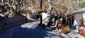
Kato Symi (or Simi) is a village and seat of the homonymous community of the…
The small plateau of Monokara is located on Mount Ornos, at an altitude of approximately…
An amazing route in the southern Lasithi mountains, moving at an altitude of 900-950m and…
Its entrance is about 200m in the west of the Monastery of Toplou. The landscape is astonishing…
The hike starts from the picturesque settlement of Metaxochori at 550m altitude. The approach to…
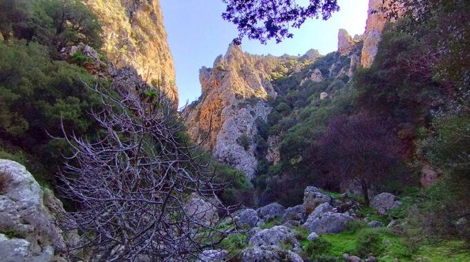
Adrianos Gorge in Lasithi: Crete’s Well-Kept Secret The Adrianos Gorge in Lasithi is one of…
During summer, on a daily basis, cars occupied by Greek and overseas tourists arrive at Pefki…
A relatively small but impressive gorge with many changes in its landscape is the unknown…
It is the fantastic jungle like gorge Richtis! The amazing gorge of Richtis is located…
Related Articles
This Post Has 0 Comments